|
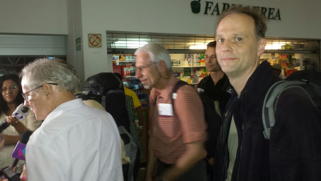
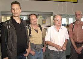
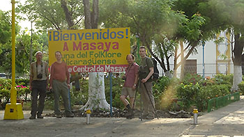
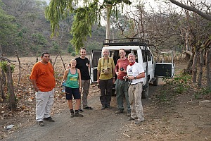
Arrival
Go to the side and wait for the other two.
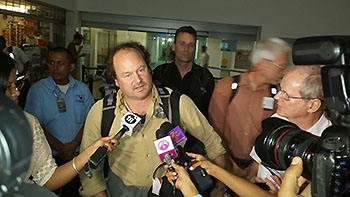
Why, I asked Marc? -we 4
should appear close in the lobby of the airport of
Managua. A surprisingly warm welcome
of the Nicaragua TV teams who
interviewed us
in the presence of Dr. Wilfried Strauch
(Ineter) and Oliver Wiesenegger was the reason.
Sure, we were plat after 16 hours of flight. Despite
the surprise effect and without textual preparation we
still could explane our intension
to capture the
Masaya in our cameras and to
describe briefly
our global longstanding volcanic
missions.
 ow ow
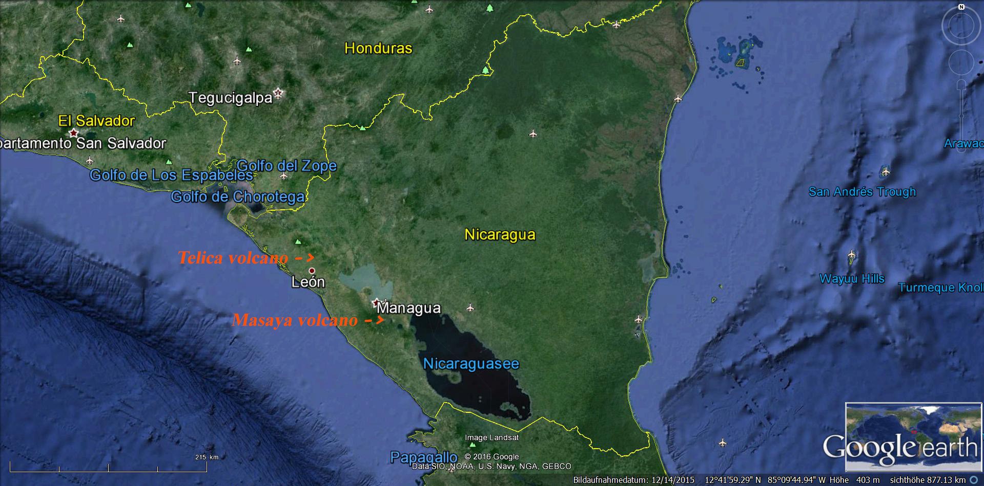
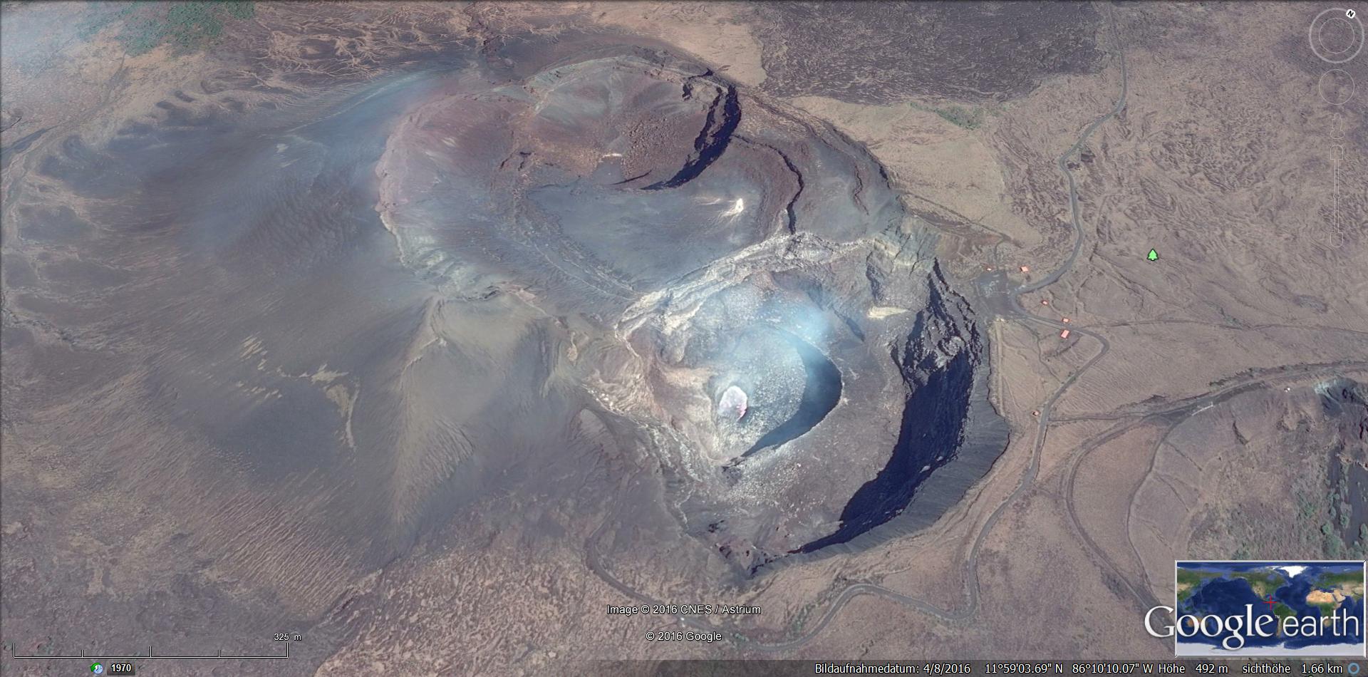
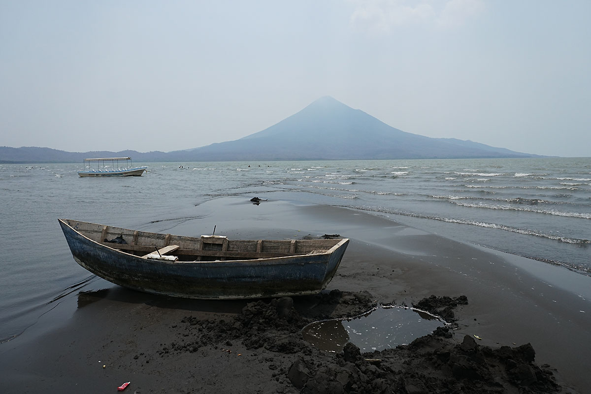
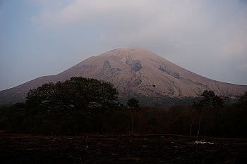
Volcano Masaya
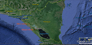
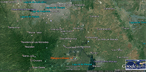
Maps by Google earth,
shows the
nearby situated city of Managua to the volcano
Masaya
If
you move in southeastern direction leaving the municipal
areas of the city of Managua,
after 20 minutes
the almost
inconspicuous and peaceful looking 6 x11km! wide old
caldera of the volcano Masaya
appears on the right side.
The access through the less eroded lava fields of the park
point out the recent activities of the volcano.

The name 'La Boca del Infierno' (Hell's Gorge) was
the idea of the Spanish conquistadors. A nightly view
from apprx. 5km distance, one might assume already
that this could be devils home. To ward off these
antipathetic guy and banish him where he belongs to,
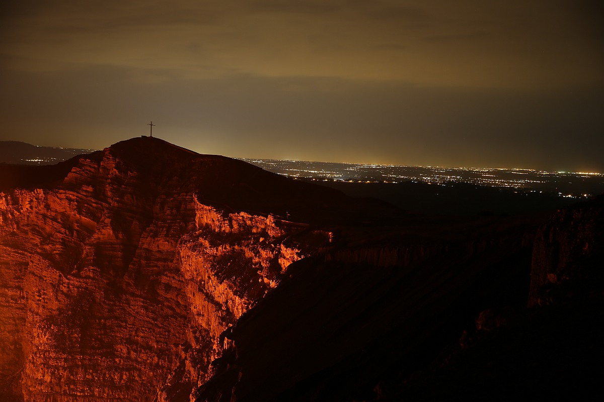
in the 16th century a cross
was erected in honor of the Church Father Francisco
Bobadilla
'La Cruz de Bobadilla'
near the edge of the crater.
Also the appearing young lava
fields have a reason. During the eruption of Masaya 1772 the
lava
flowed
in a spacious area which is now called
Piedra Quemada (burnt stone). Very interesting was the
naming of the indigenous population, 'Popogatepe'. This name
in Nahuatl for a burning mountain, was also the ancient
nomenclatur for the mighty volcano
Popocatépetl
in Mexico, whereby the violent
eruptions were also interpreted as the anger of the gods.
Back to Masaya. Also sacrificial rituals were reported by
the Spanish conquistadors in the ancient times. To appease
the gods, the local population
brought human sacrifices to
the volcano.
 ow ow

Maps by Google earth
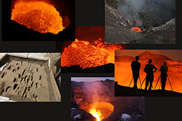
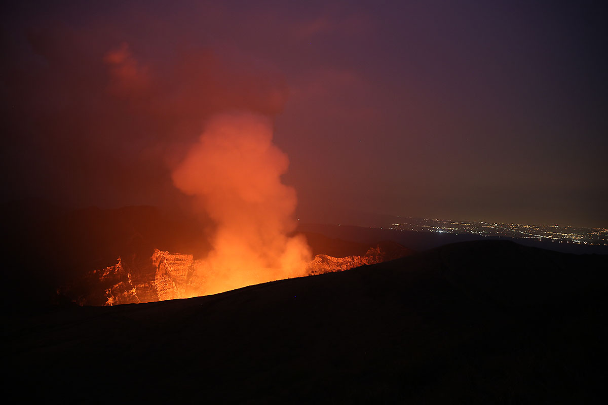
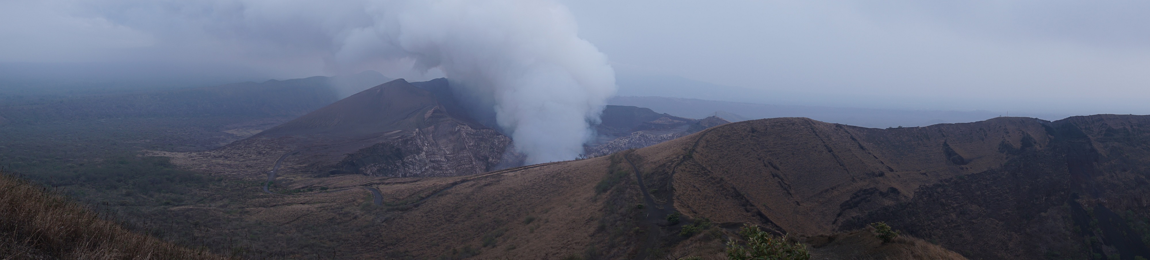
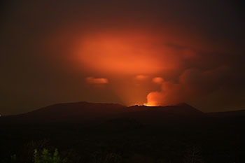
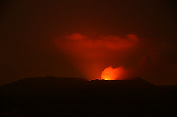
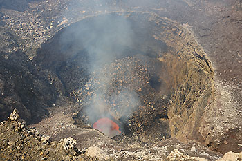
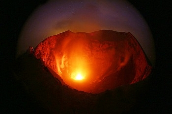
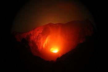
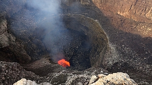
Arriving in the city of Masaya and the "younger
active' crater area, with a length diameter of
about 1.2 km

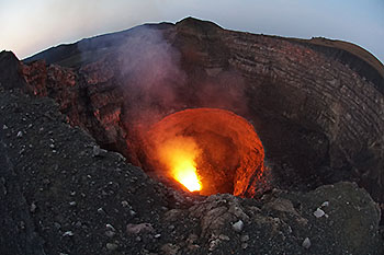
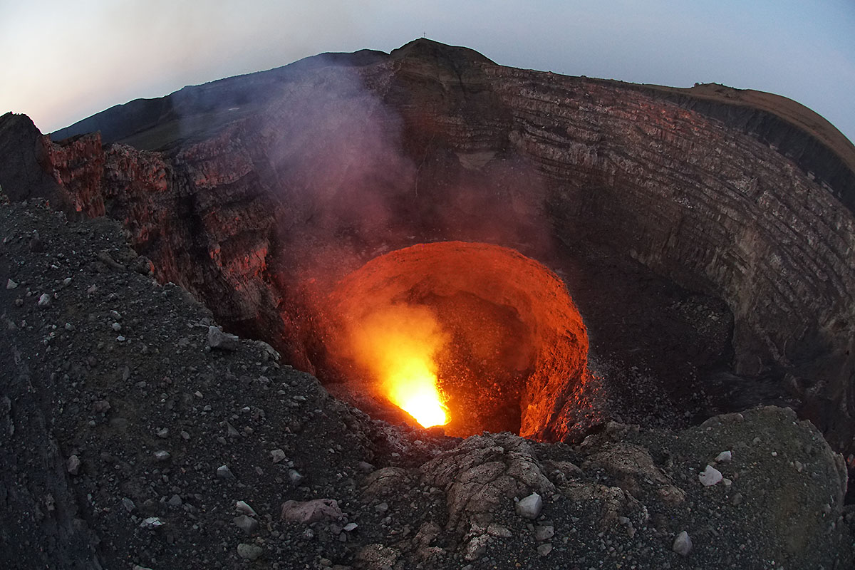
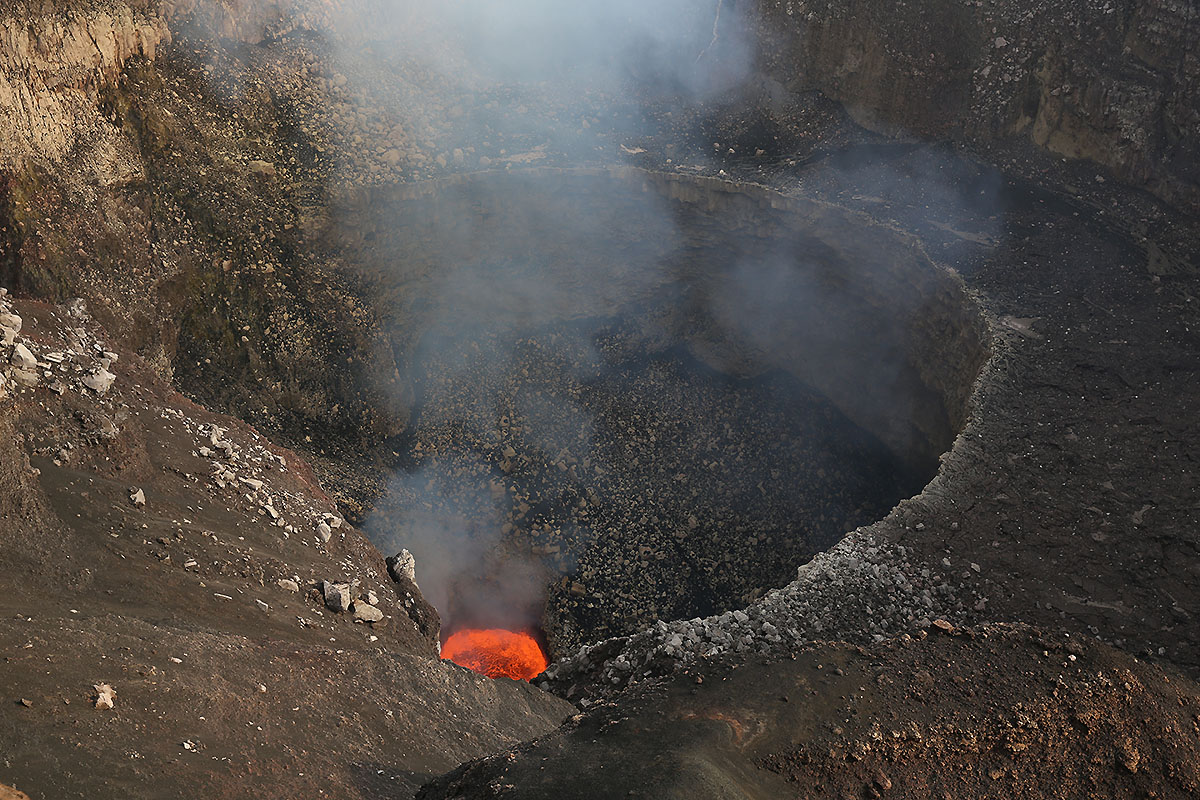
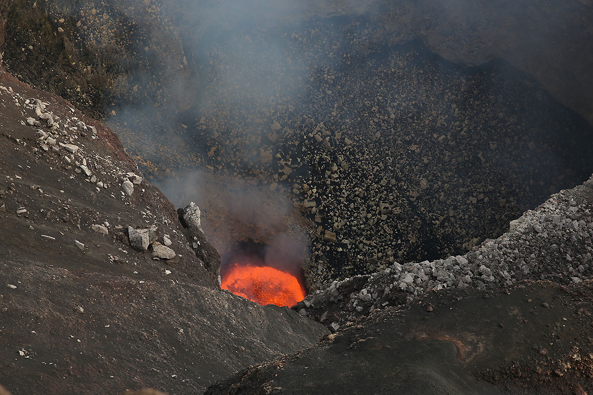
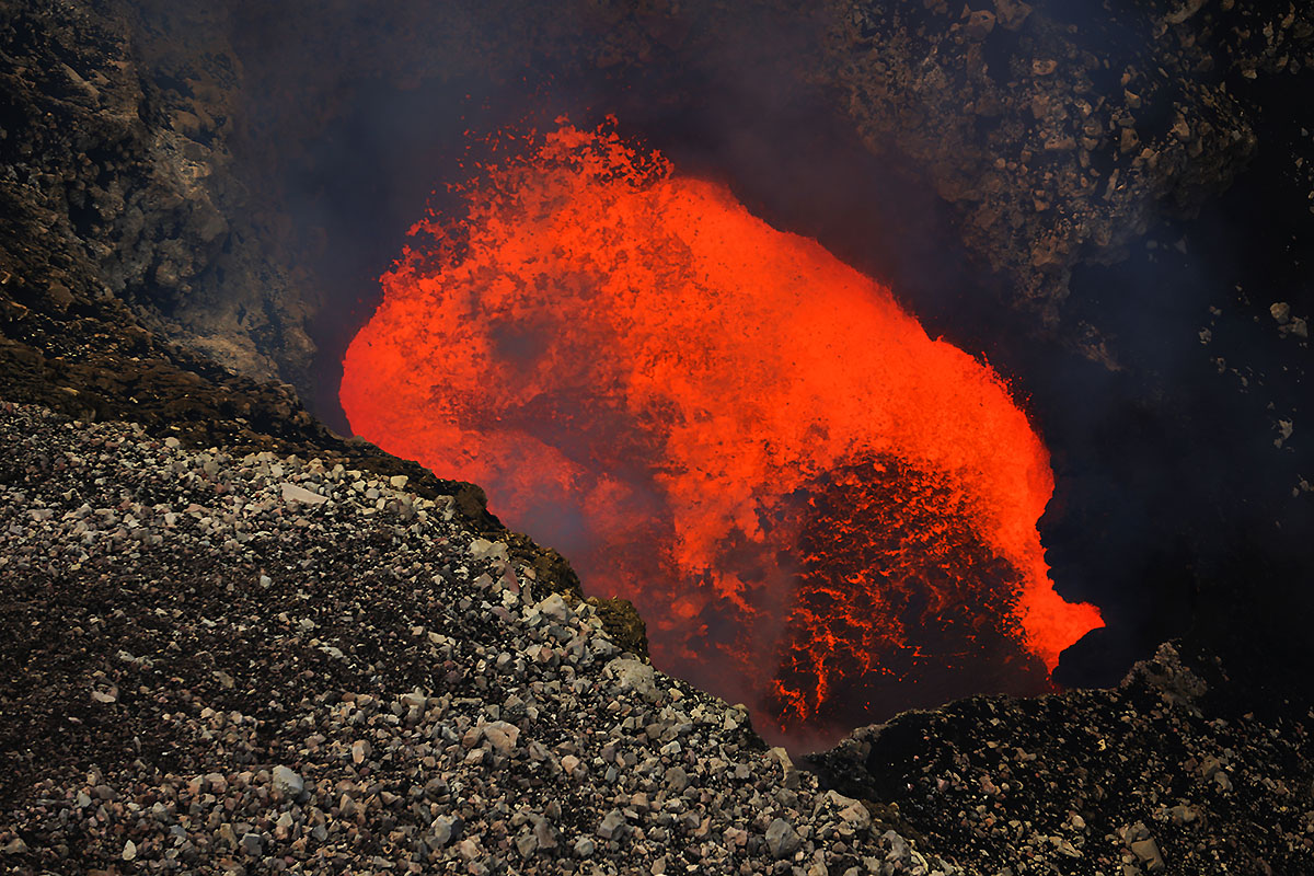
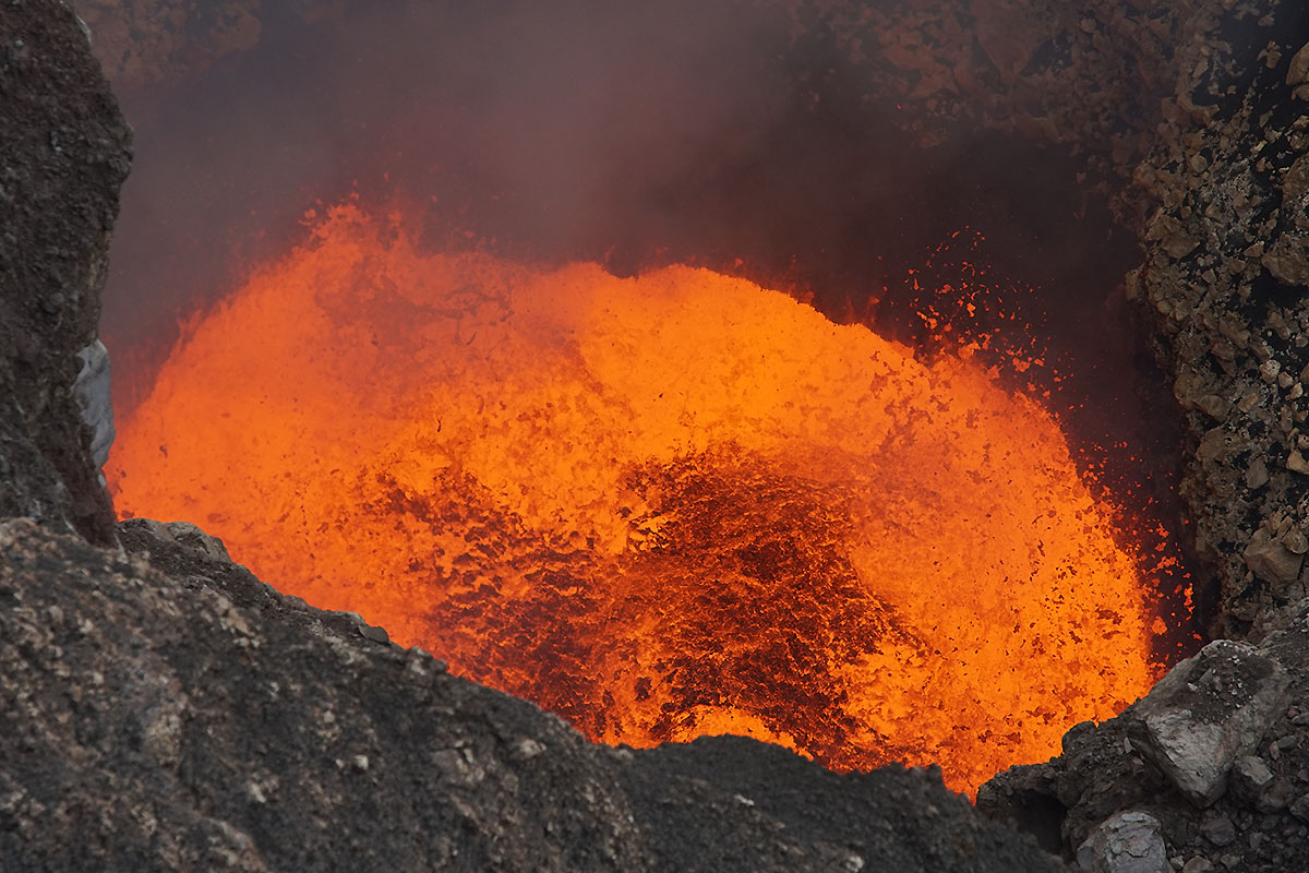
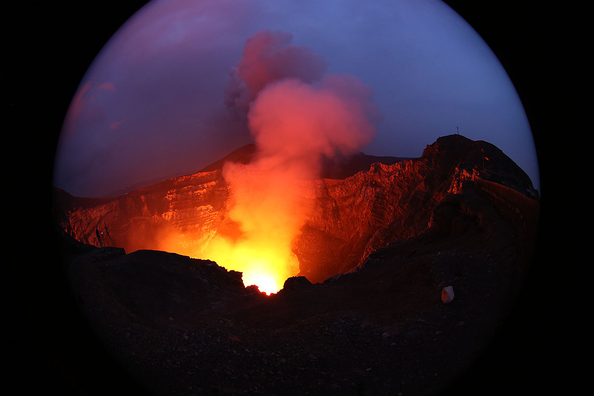
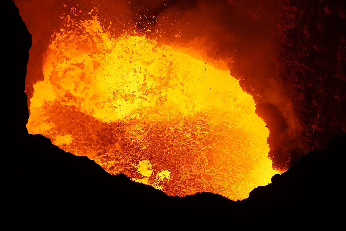
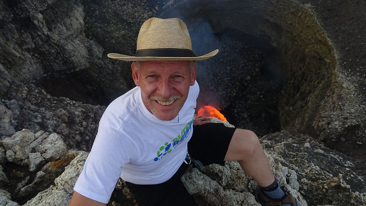
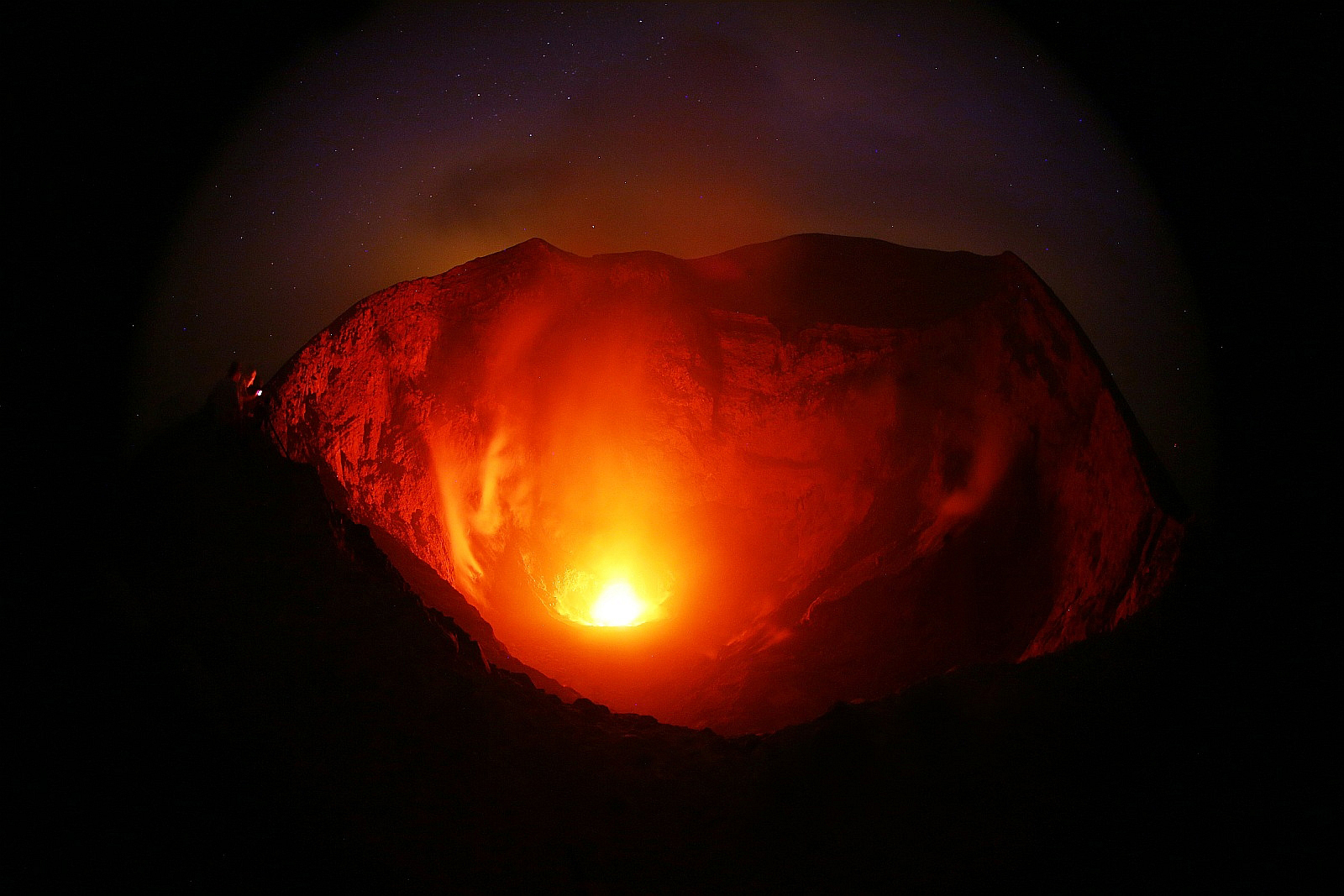
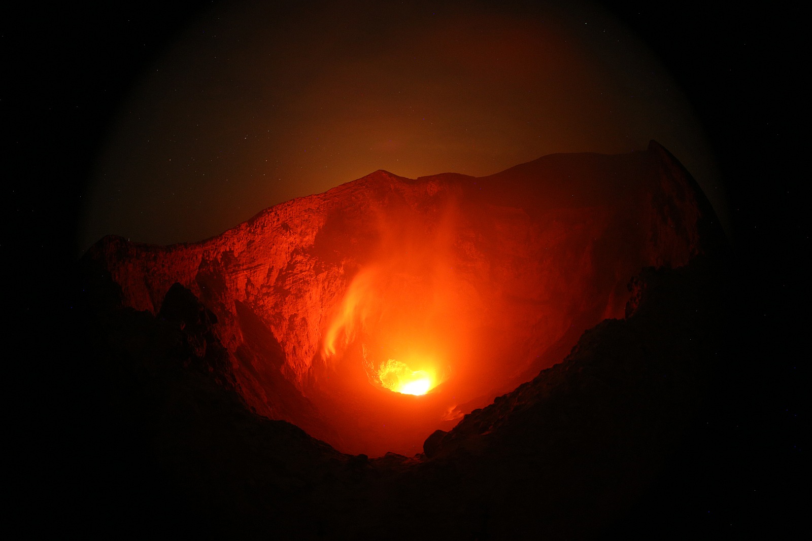
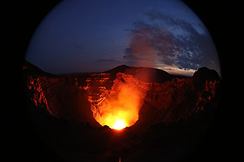
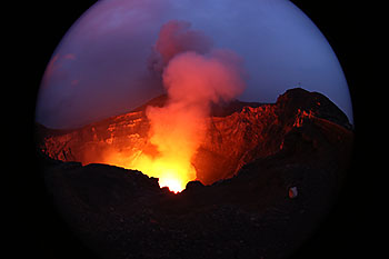
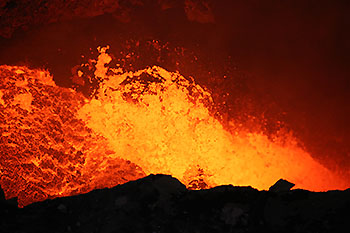
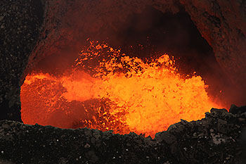
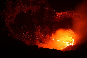
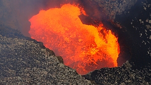
The actual active Santiago crater with a diameter
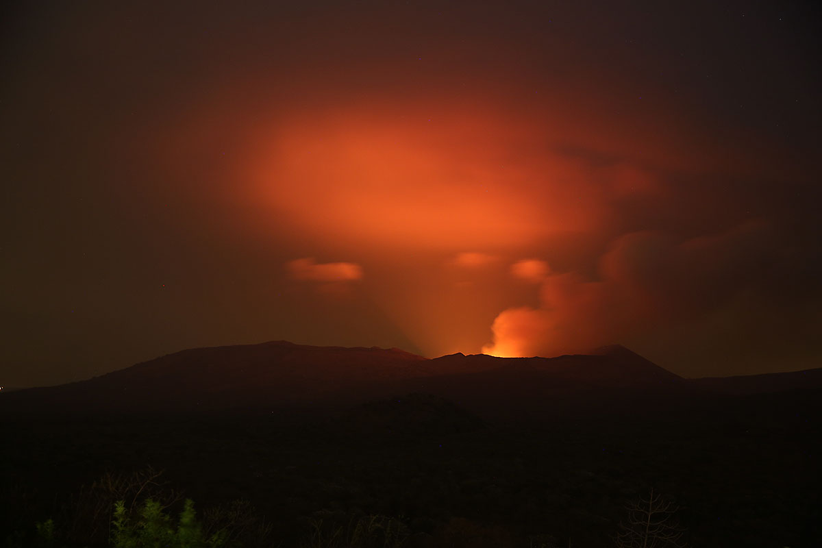
of 400m and an estimated depth of 250-300m.
 
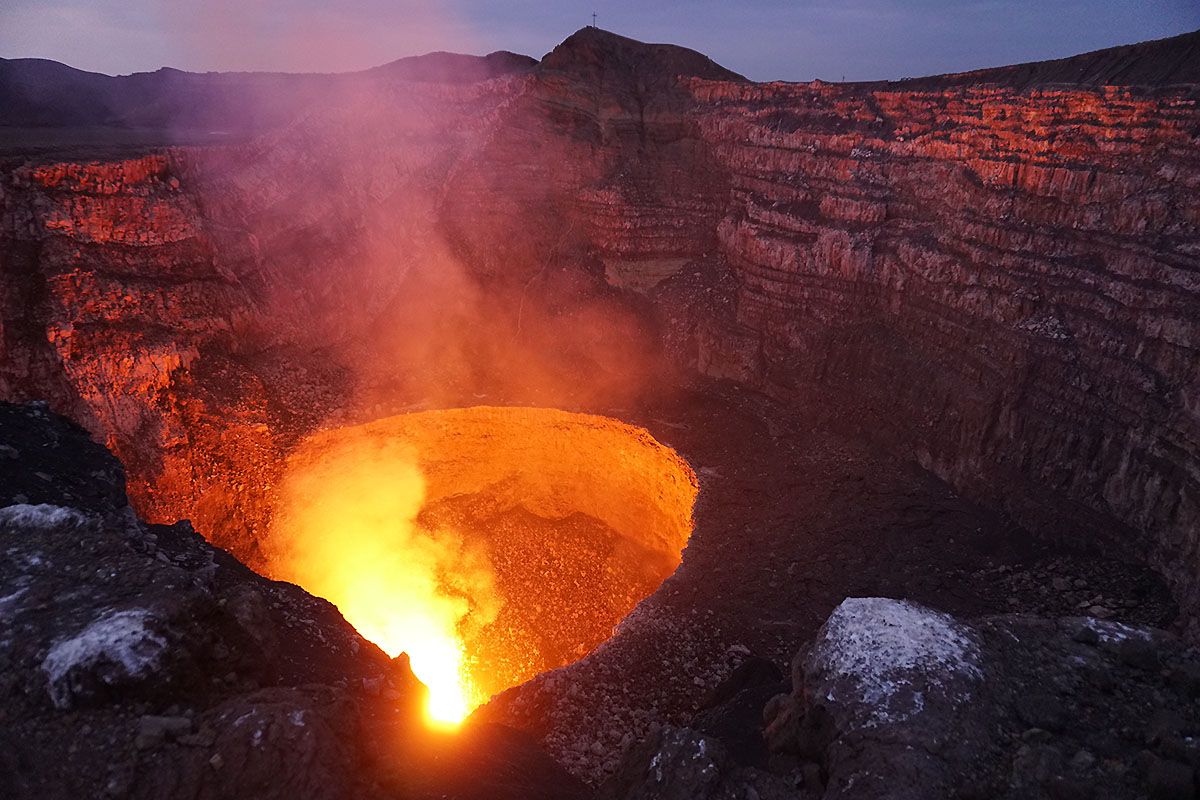
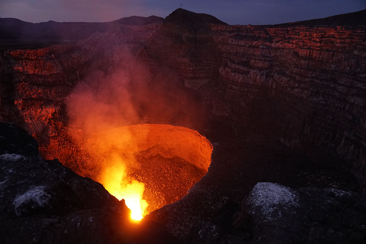
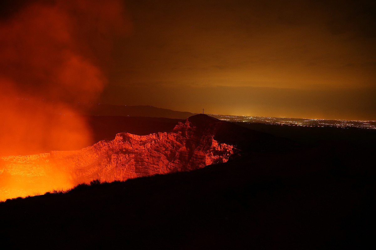
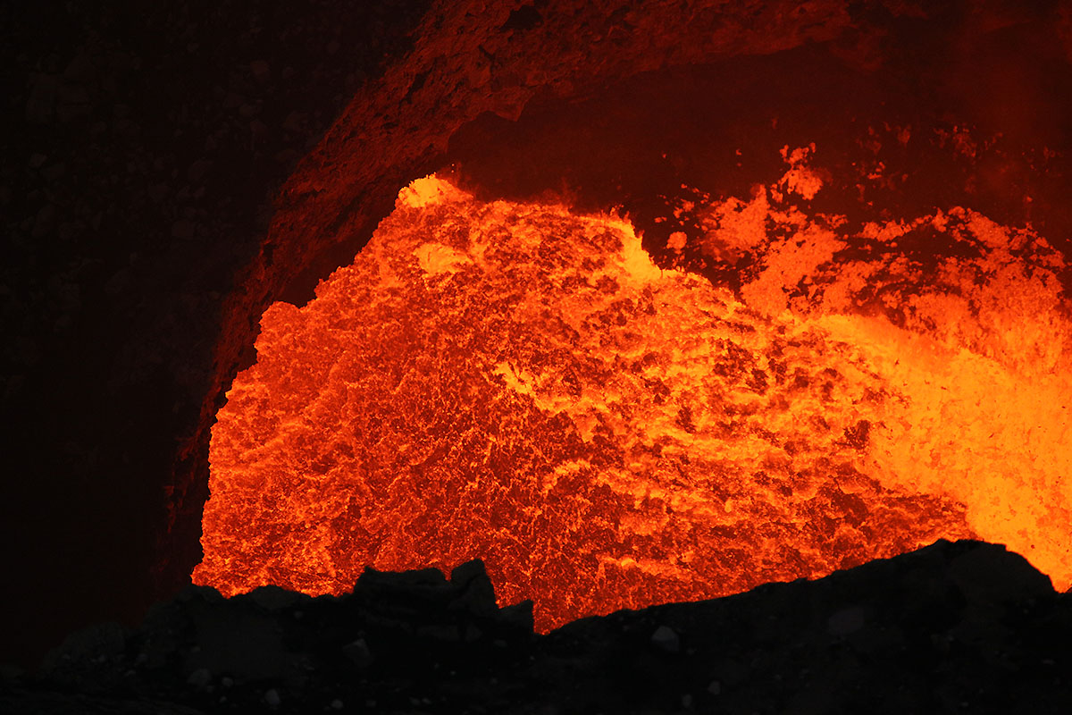
The budding darkness reveals the strong activity
of the lava lake. The inner semicircle measures about
160m in diameter.
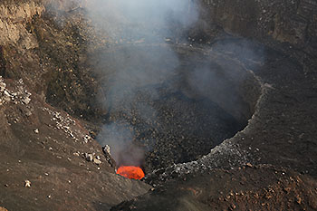
The wild bubbling lava sea has
the dimension of may 20x40m
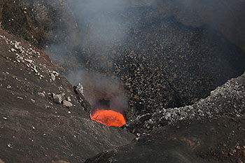
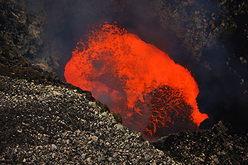 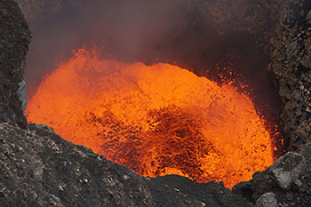
The crater walls are
reflecting the bright red lava of the sea.
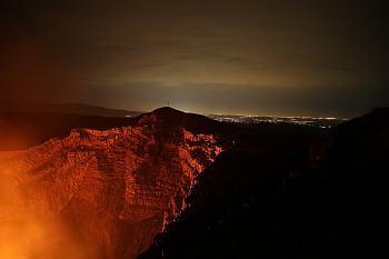 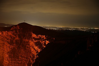 
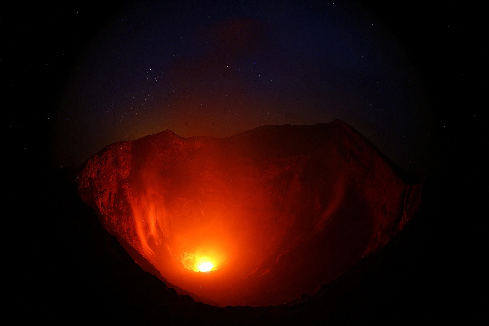
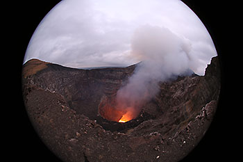
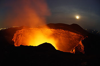
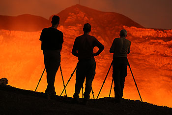
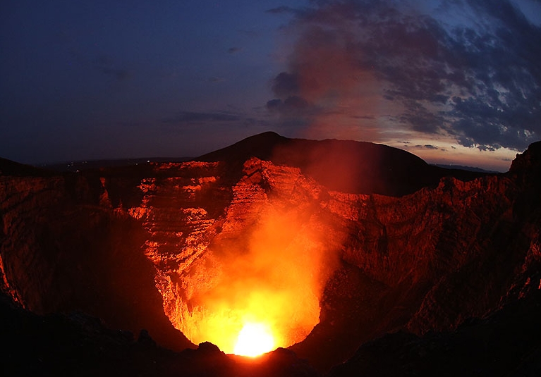
Right in the background the city Managua. The
volcano is located quite close to the city, but it
requires a very violent eruption to bring the nearest
populated areas in danger.

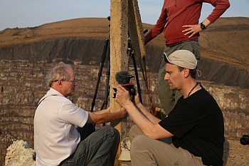
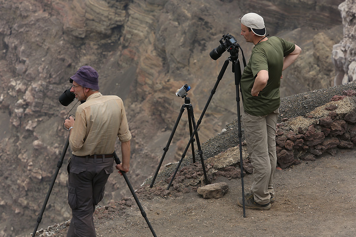
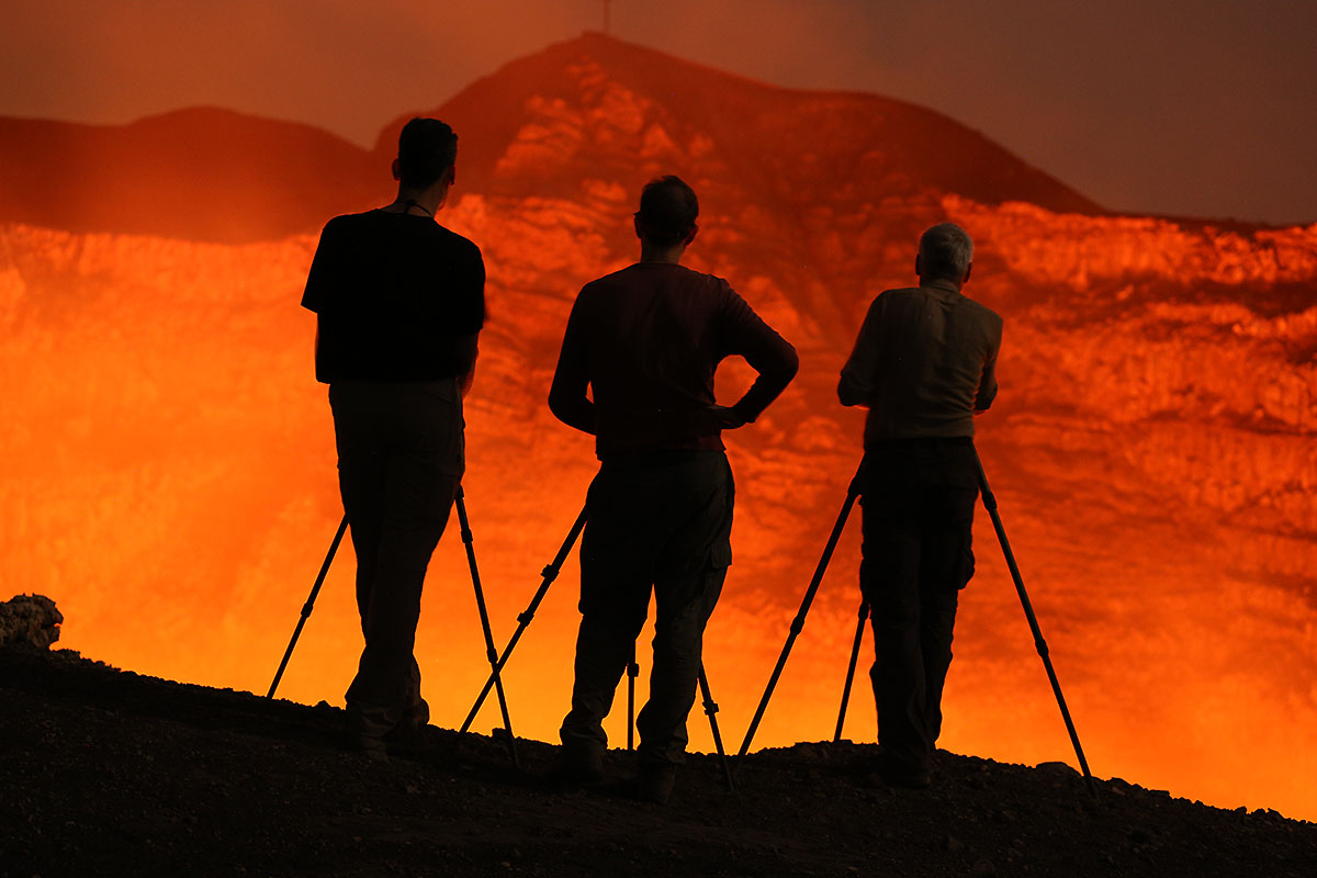
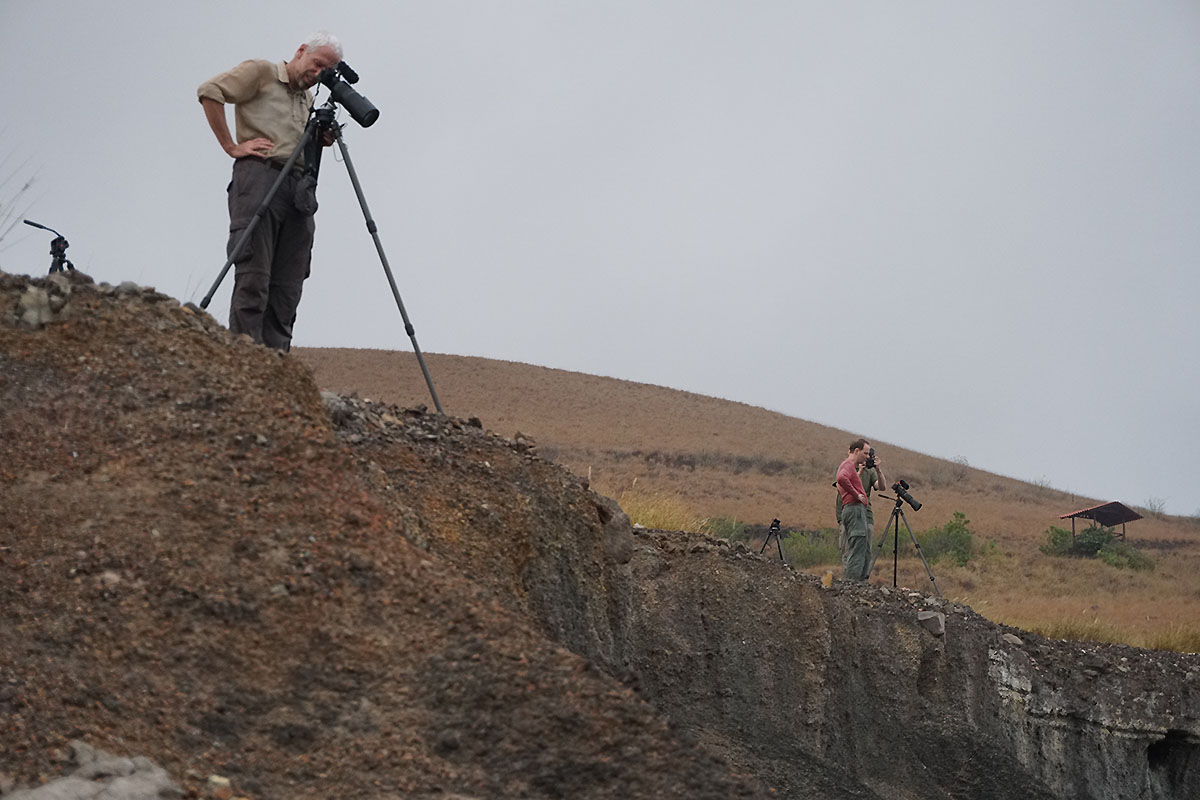
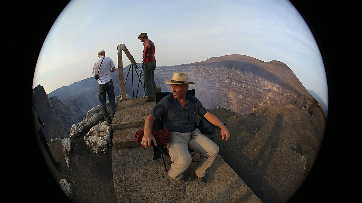
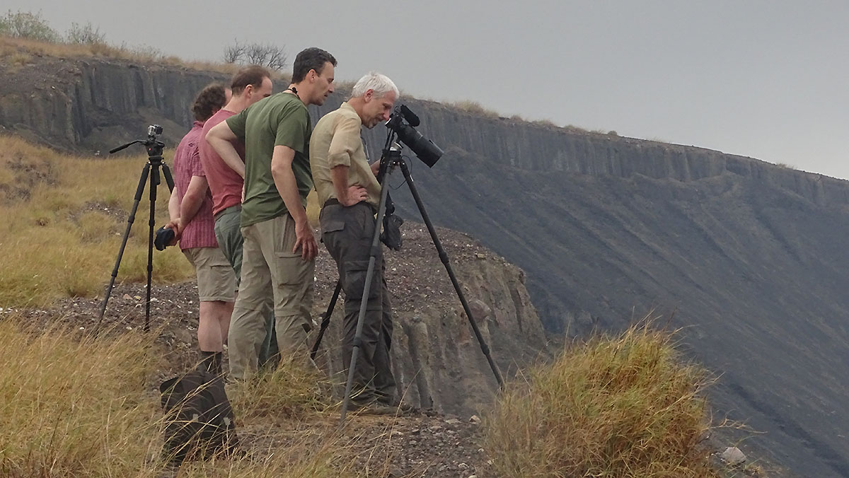
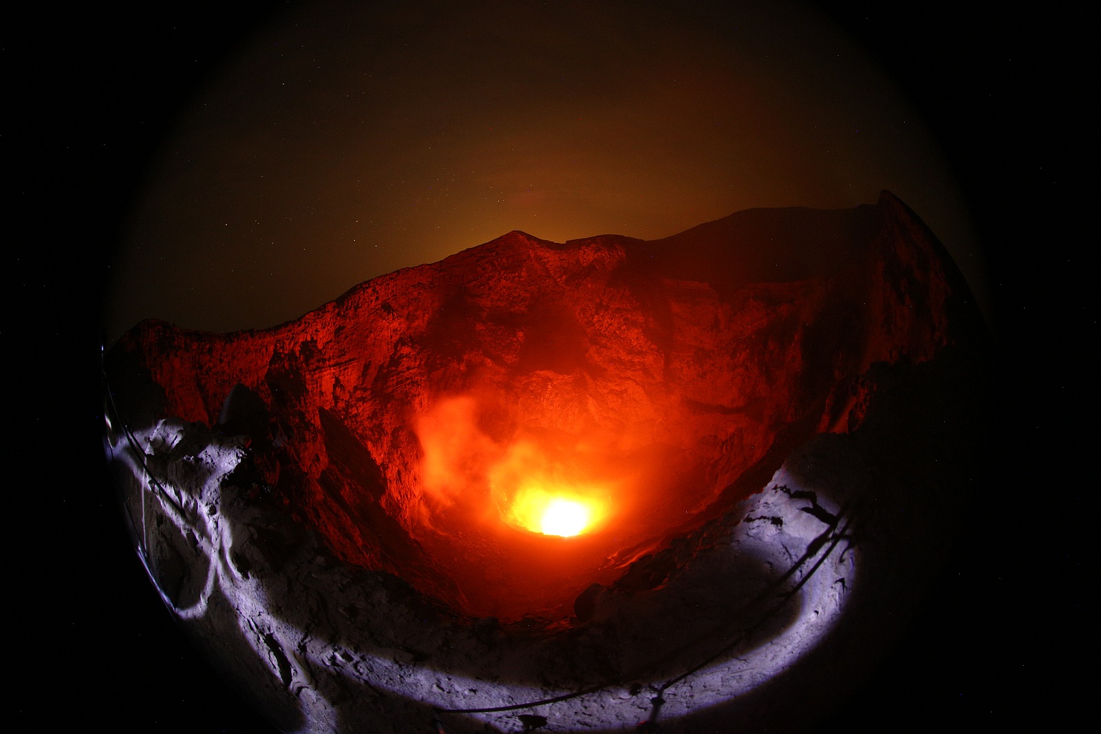
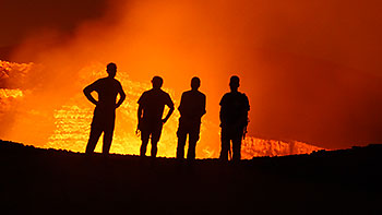
Martin and Marc with strongly
inclined camera at the near edge. Here absolute
caution was necessary, because the inclined surface
zone often consisted of loose slag material. Then 100m
vertically downward walls will expect you. Right photo.
Dr. Wilfried Strauch in an interview with Marc.
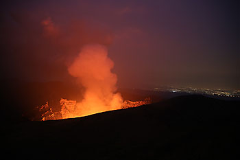
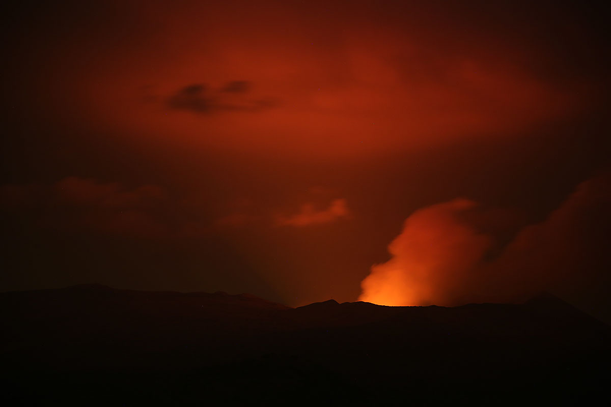
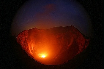
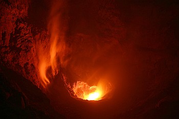
Light impressions at the crater ...
 ow ow
..and our 'shadow existence' at the crater
rim

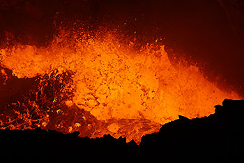
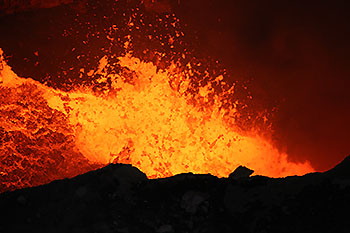
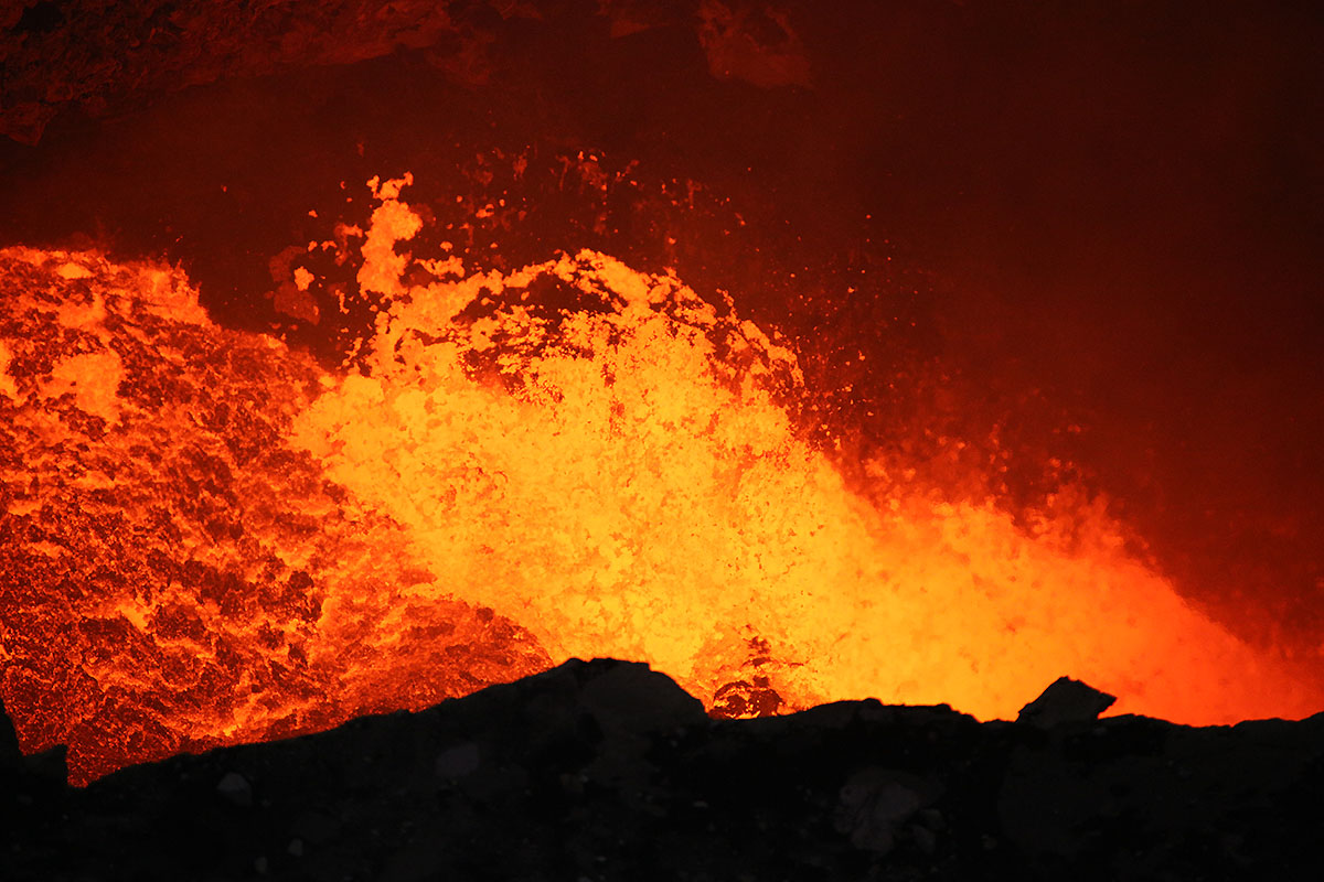
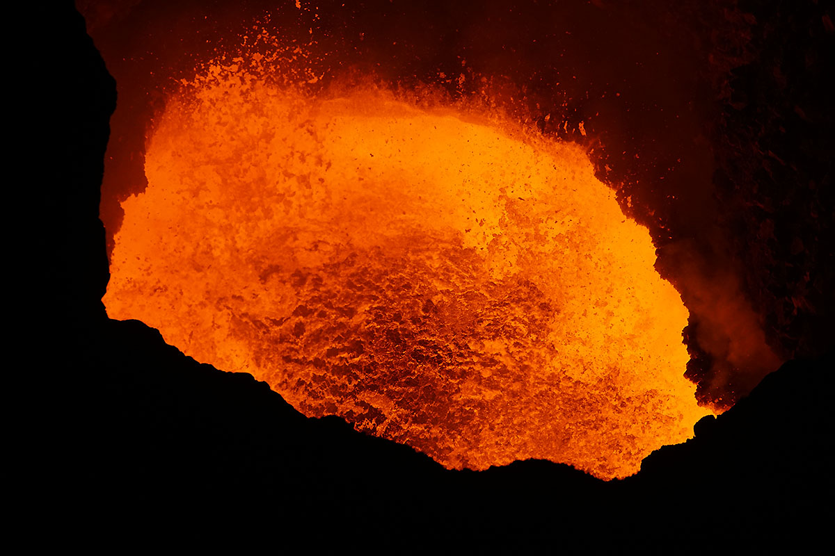
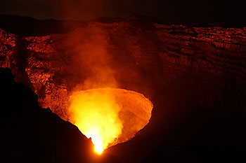
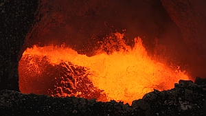
Momentary shots show the wild lava lake which apparently increased
during our presence in its activity.


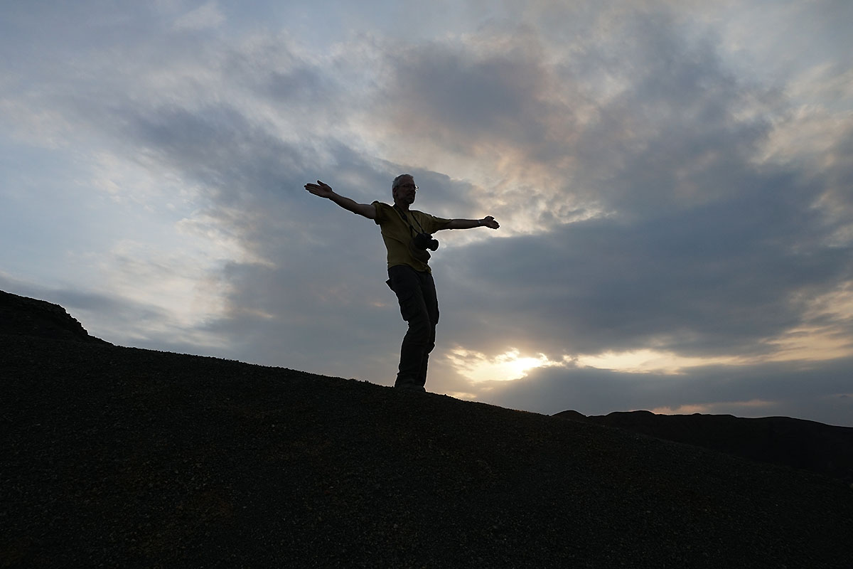
Martin and Richard at the steep edge. Right: This is how
freedom l ooks!

 ow ow
 ow ow
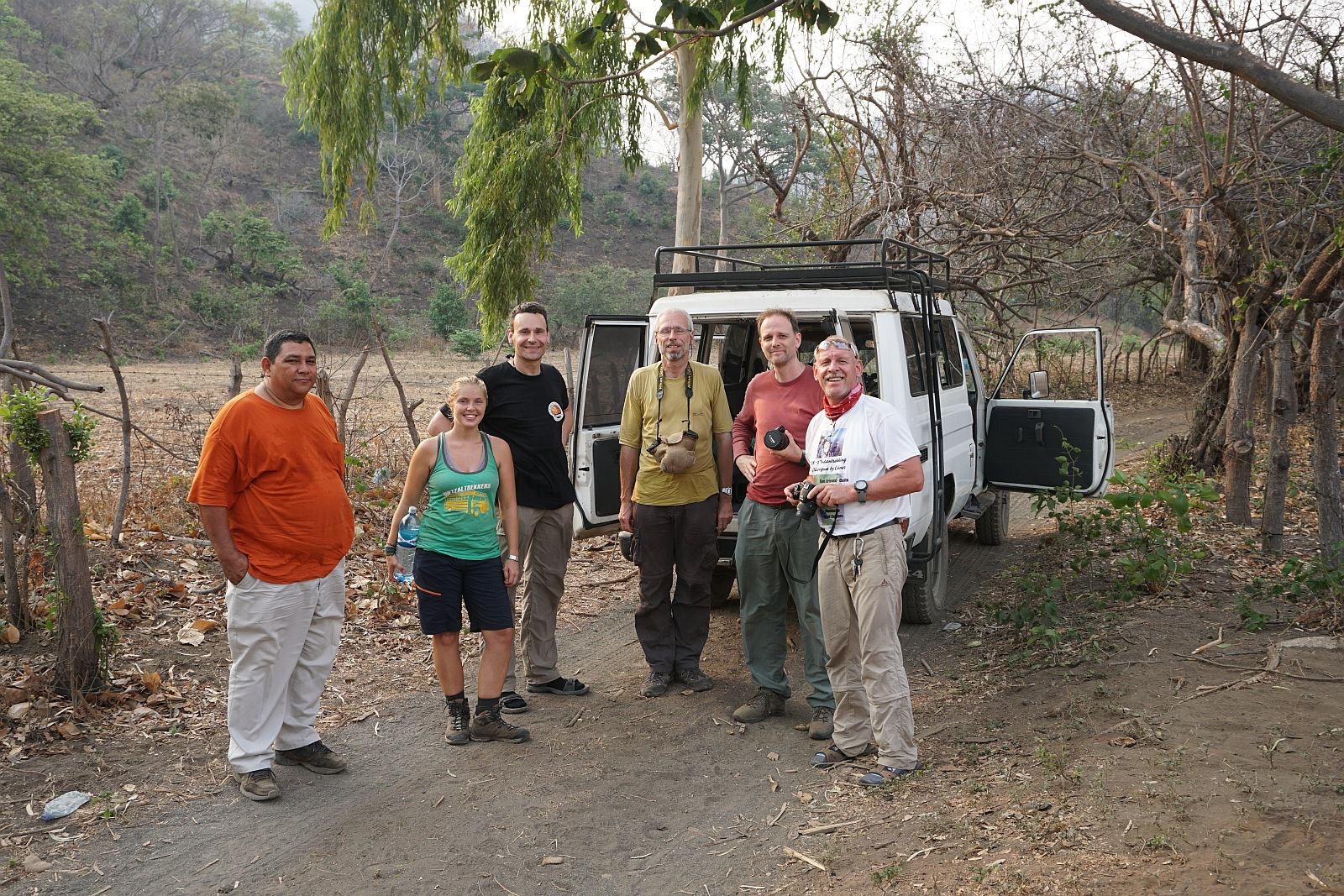
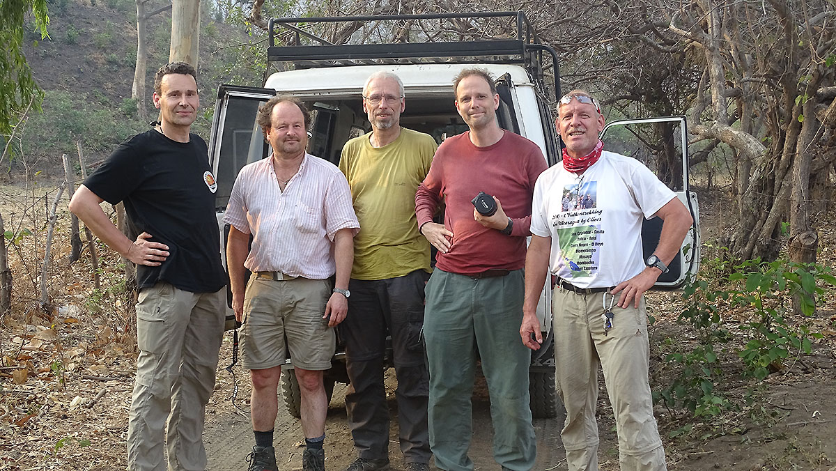
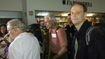
Oliver, a perfect companion with inexhaustible knowledge
about the volcanoes of Nicaragua and the history of this
country.
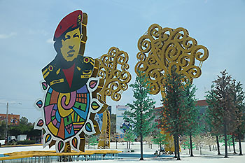  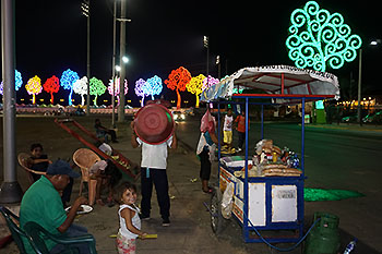
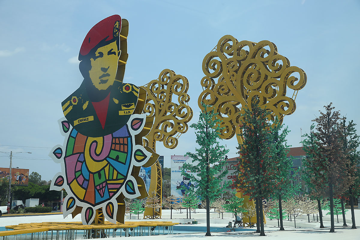
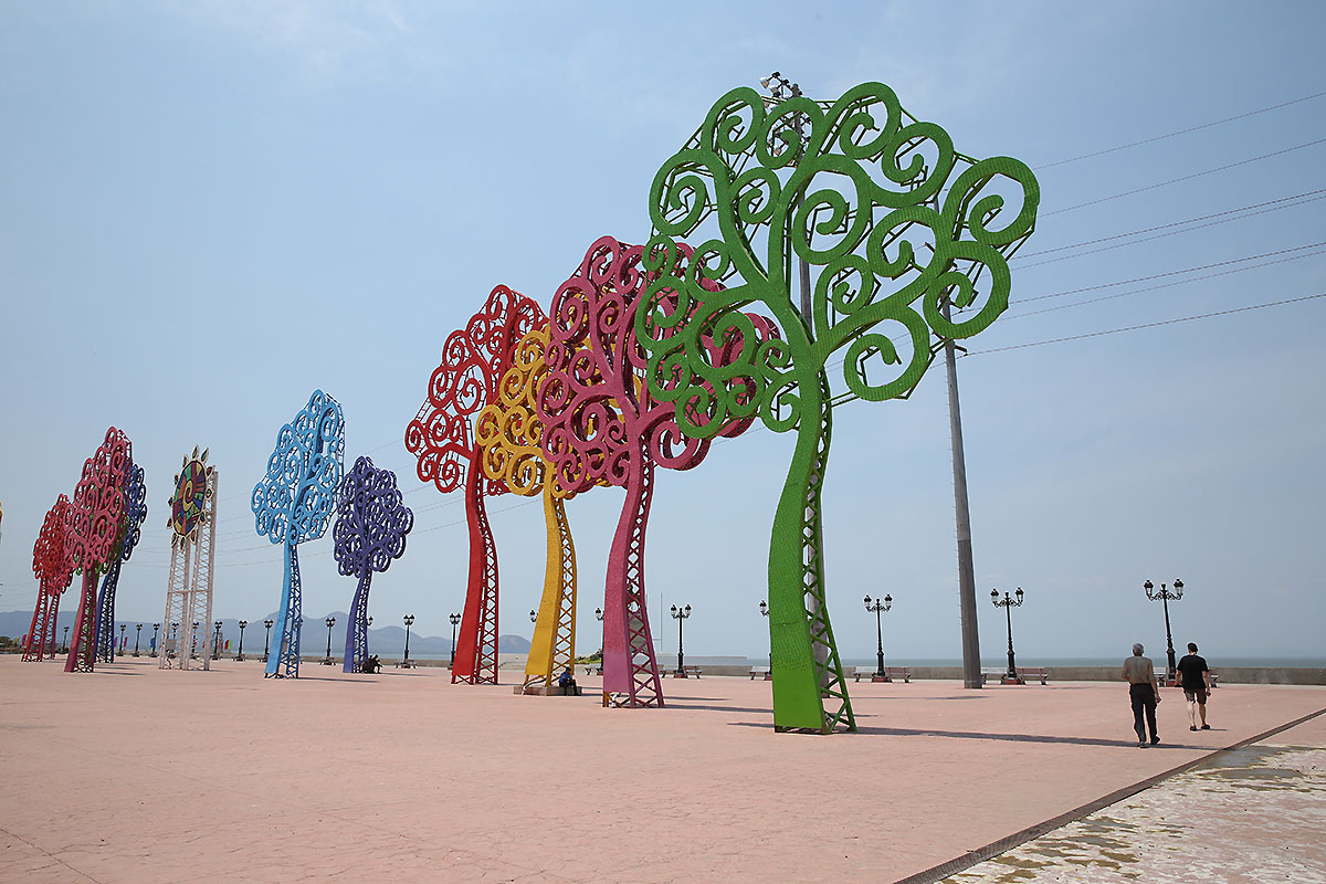
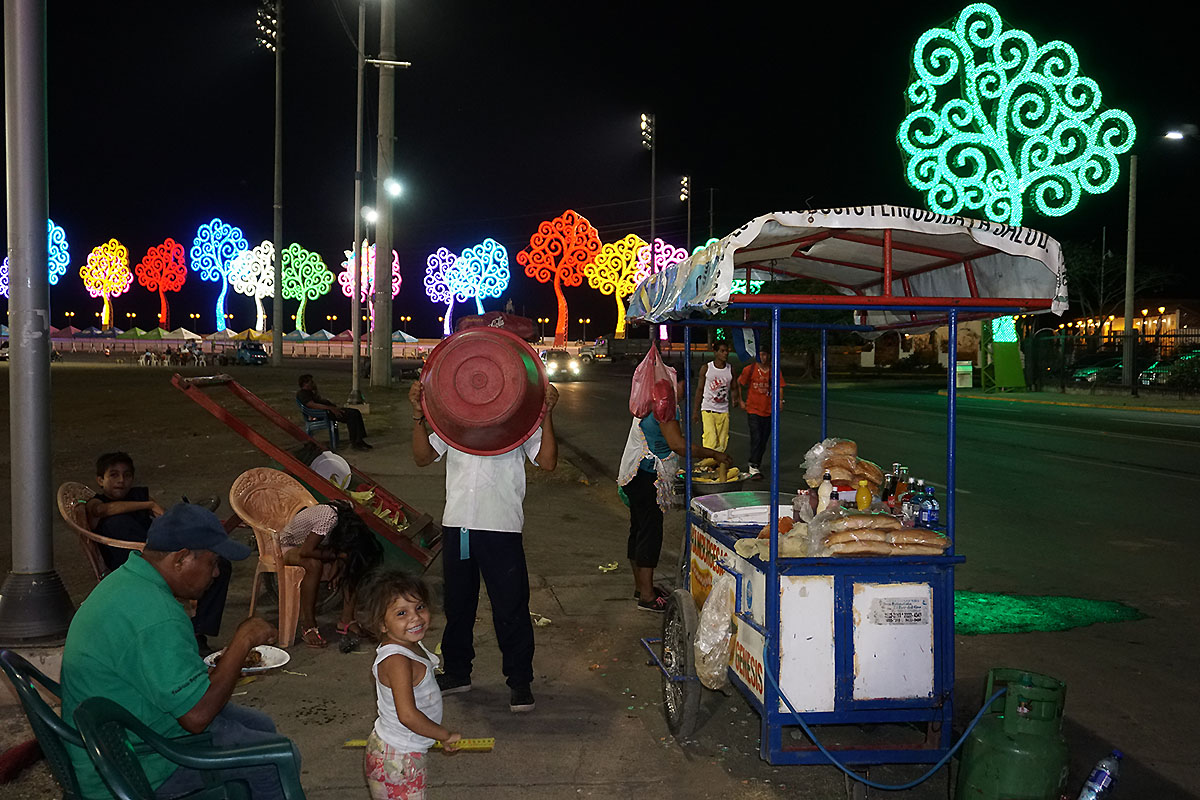
A surprisingly colorful and unique
feature in the
city of Managua. Even at the nightly
landing overfly this 25m high steel trees
fitted
with thousands of light bulbs,
are visible remarkable.
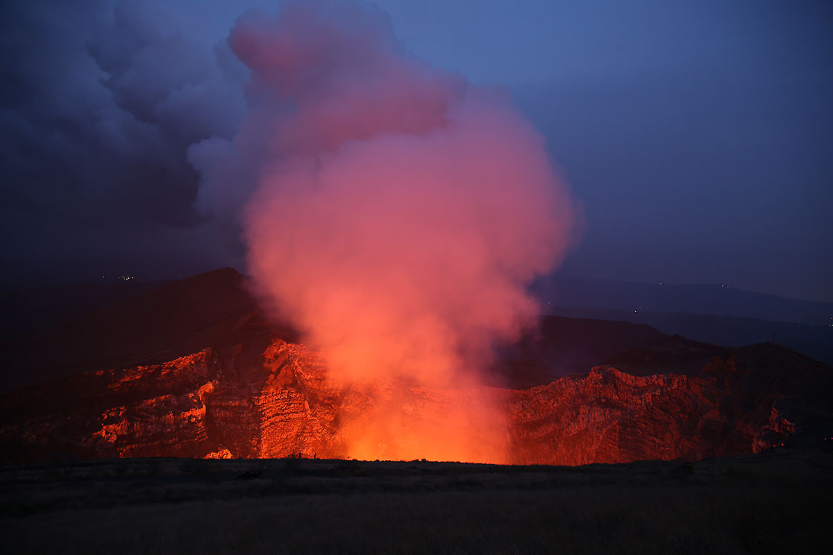
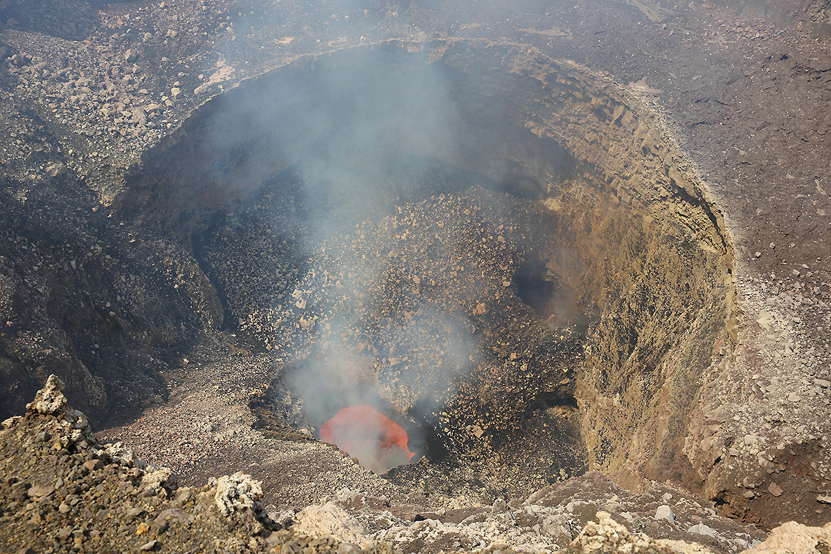
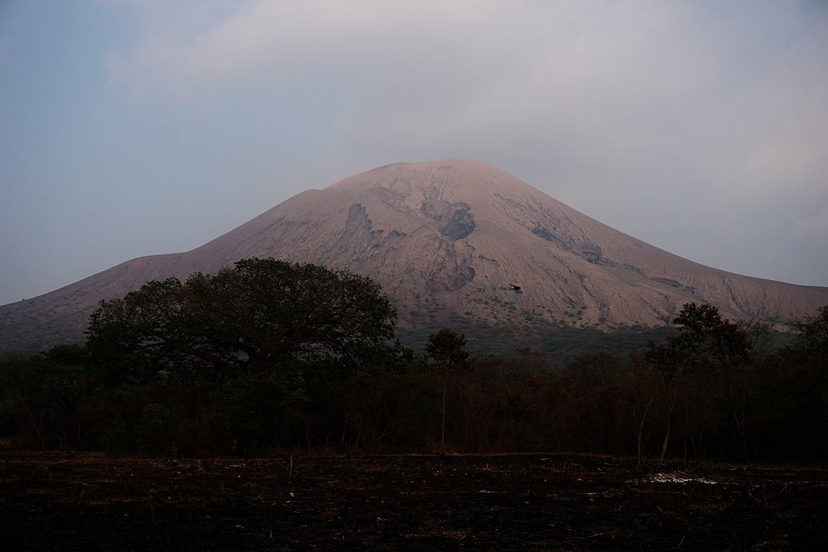
Volcano Telica
The currently active volcano Telica was also
in our
mind, and so Oliver
organized
a trip passing the city of Leon ca. 100km in
the north west direction.
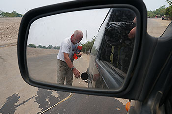
A small security refueling by using plastic bottles ;-)


The route was
also
passing the Momotombo volcano. In February the
volcano did make trouble with explosive outbursts,
lava discharge and pyroclastic flows. In our case, the
1297m high volcano just had a rest, but an possible
active phase may can occur again. Links at bottom of
page.

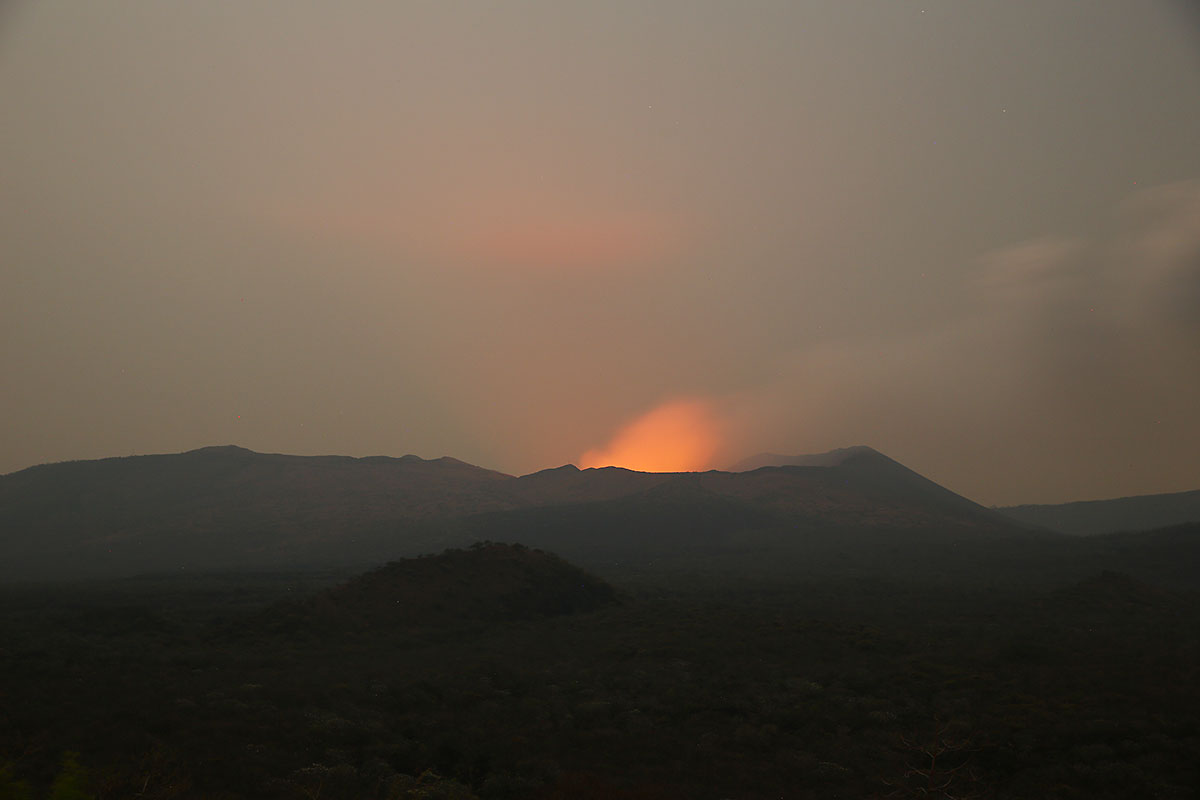
After a bumpy four weeled tour of 1.5 hours we reached in
the afternoon the volcano Telica with its 1021m altitude. An
approaching storm front stopped our urge to explore
initially but after the celestral electric more or less
ceased, we ventured late our climb.
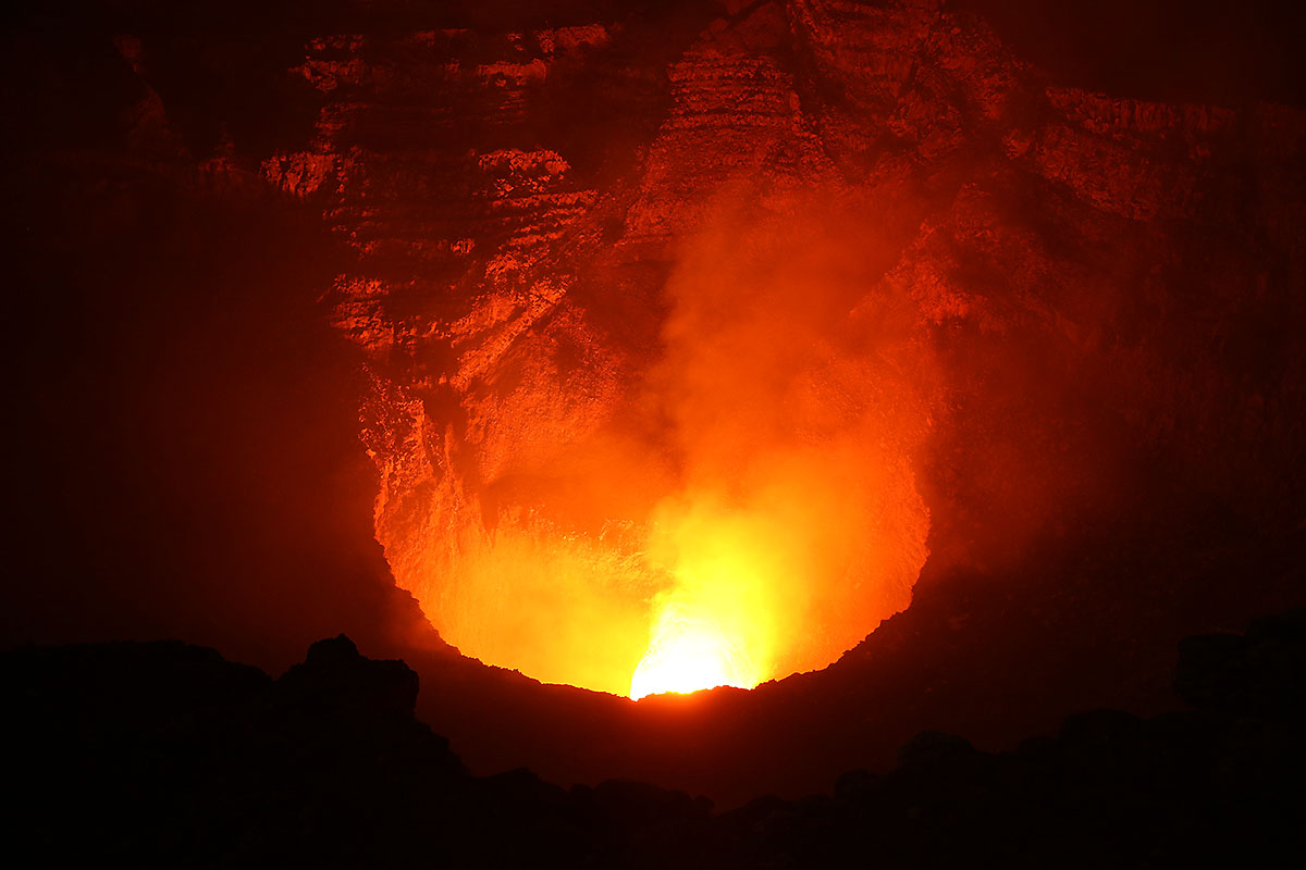
This was the reason that
the deep view was possible into the mighty crater
only after dark.
But the view was impressive. Also the sound was
very unrest and it seemed that there is a strong
steam discharge under high pressure.
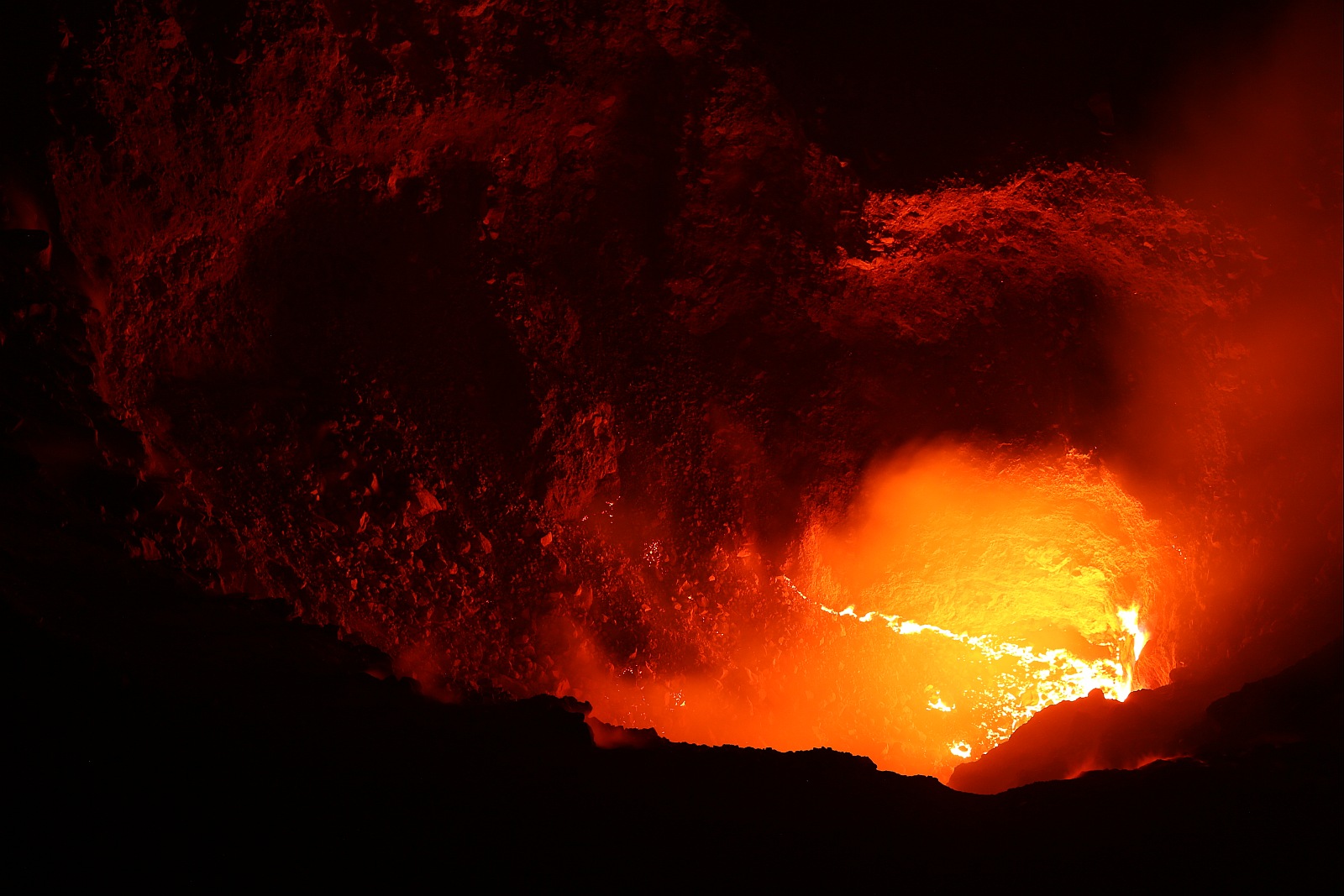
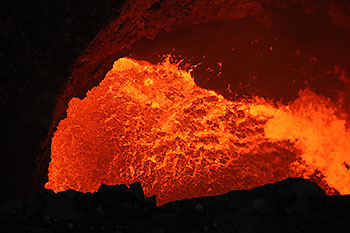
Some more details from the interieur. On the
left photo a lava sea or flow which was moving
very slowly on the bottom is shown. All in all
it was a phantastic climb to a volcano which is
rare documented
and monitored only via web cam.

The apreciation: After an important part of my tripod
head made itself secretly independent in the car, I
was heading out very perplexed at the Telica crater
rim. Only with Olivers tripod loan I could succeed
these recordings. Oliver! - Your tripod is as promised,
honored until doomsday.
 ow ow
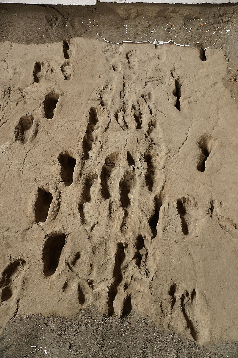
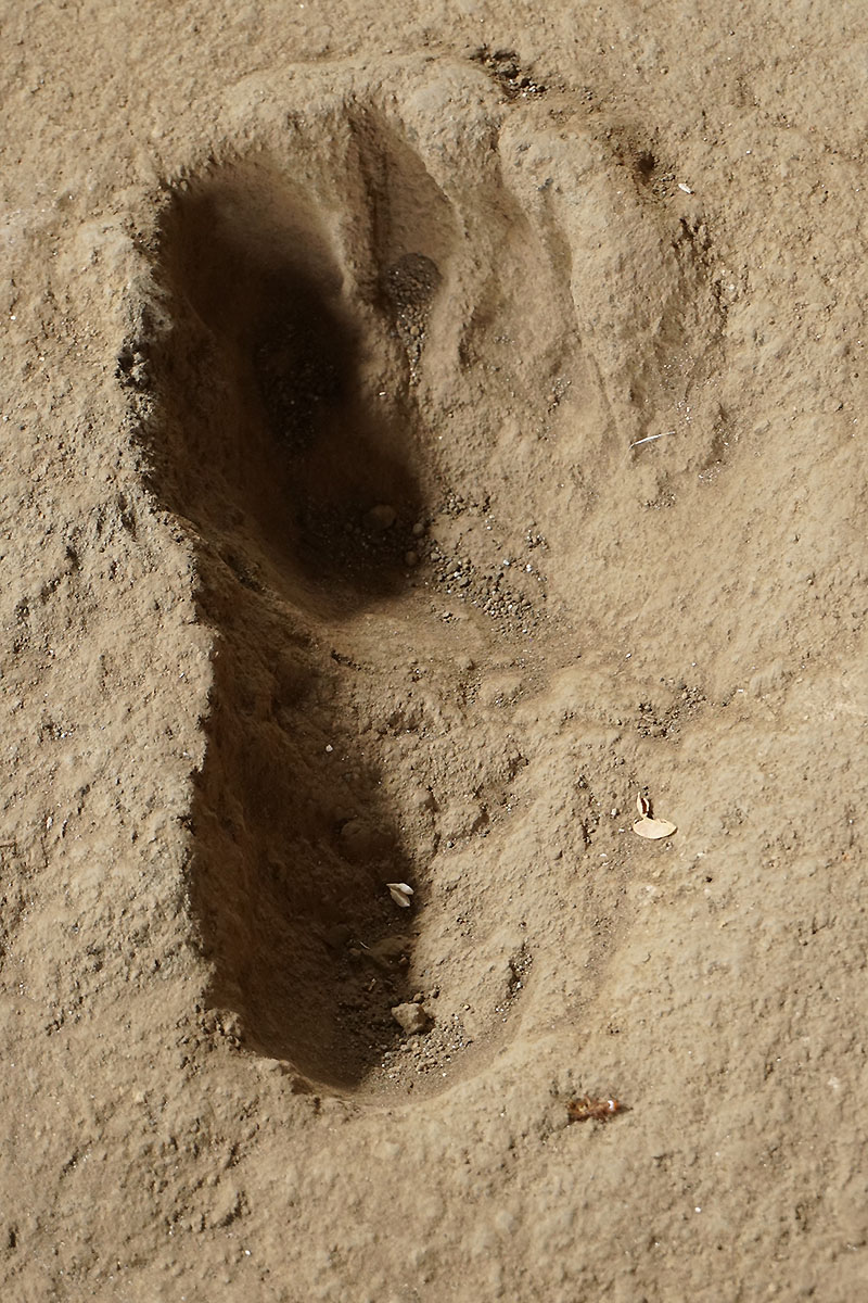
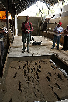
The 6000 years old traces of Acahualinca
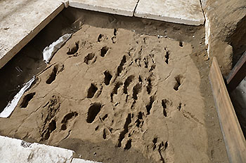
An extremely interesting discovery was made in the
development and subsequent excavation of the
dewatering channels in the urban area of Managua.
After the C14 method, these footprints are about 6000
years old and let suggest that a family with their
farm animals left their footprints in a previous
sludge disposal during an eruption of Masaya on the
run.
The sludge was burned
literally by the subsequent hot ash fall and thus
these traces were 'conserved' till now.
Yet,the measurements of age differ from the results. The
museum director told us that German scientist could
determine the age of the prints for about 2,500 years.
At this point a big Thank U for Marc Szeglat who
built up this contact (hard work). Also to Dr. Wilfried
Strauch from the Instituto INETER and to Oliver
Wiesenegger which made it possible to get an very
professional guidance and the entrance to the restricted
areas of the volcano Masaya.


More about our Nicaragua Tour at
ALPE
vulkane.net

|
|
 V1
V1
 V2
V2
 V3
V3
 A1
A1