Things started badly
with the BA plane circling so often over Antigua that we
were getting rather dizzy. Finally, having landed and
endured the slothful immigration procedure we managed to run
with our luggage and check in to the last Winair flight of
the day with 20 minutes to spare.
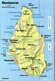
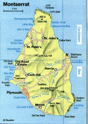
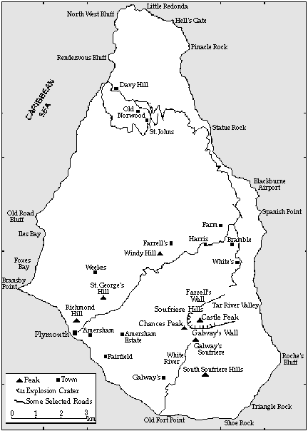
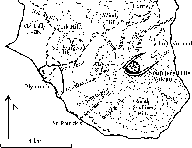
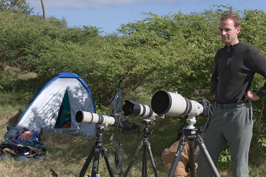
Maps for
orientation
After the short hop to
Montserrat in the trusty old DHC-6-300 plane, we quickly
exited the airport and grabbed a taxi to go and stock up on
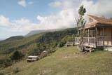
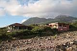
water and get some additional food. Then we drove to
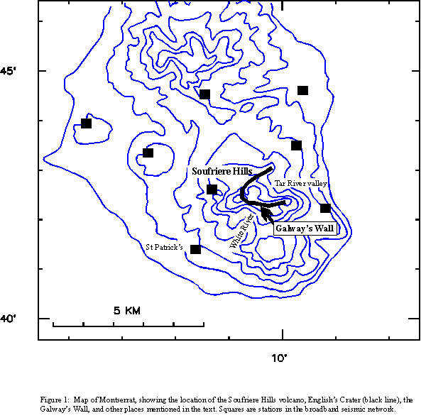
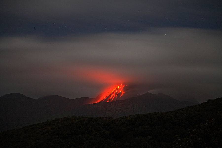
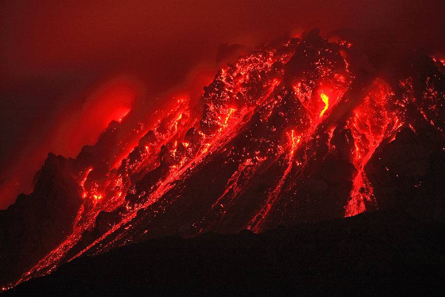
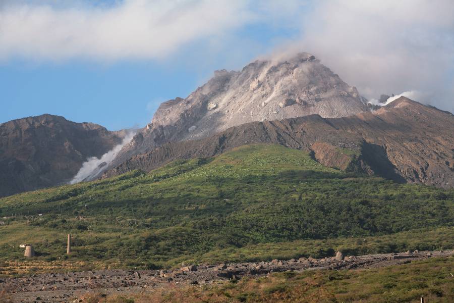
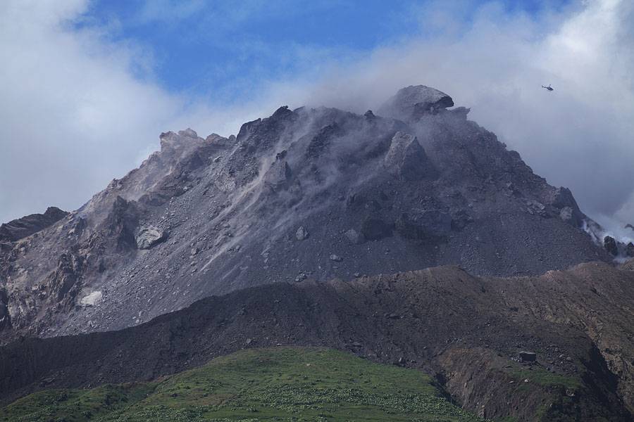
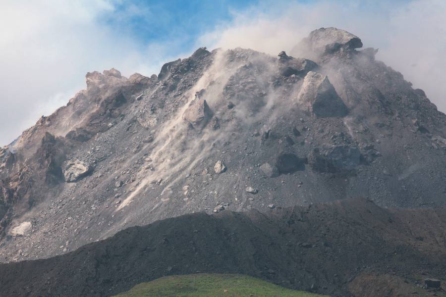
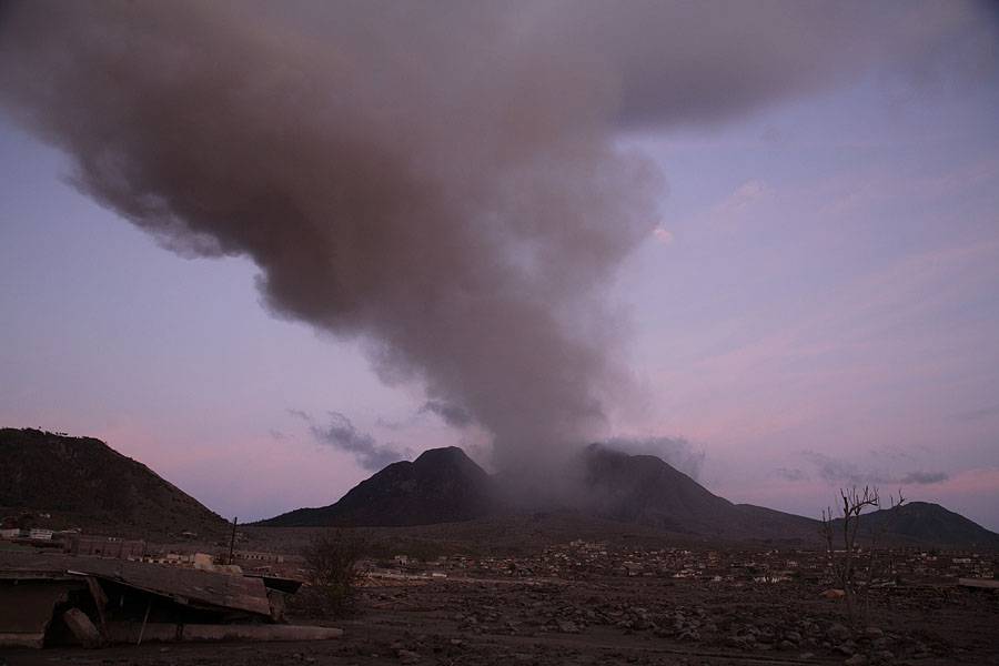
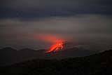
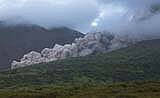
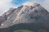
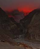
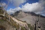
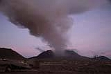
the Jack Boy Hill observation point (Fig.1) to be greeted by
the glowing dome of Soufriere Hills Volcano with only a
small cloud cap sitting on top (Fig.2a, 2b, 2c). Since
weather conditions often prevent any viewing for
lengthy periods, it was a great relief to see so much so
soon after arriving. This was the first view of the
volcano for Martin, whereas it was already my third visit to
the charming little Island with its ever-changing volcano.
 1(rr) 1(rr)
 2a
(mr) 2a
(mr)
 2b(mr) 2b(mr)
 2c(rr) 2c(rr)
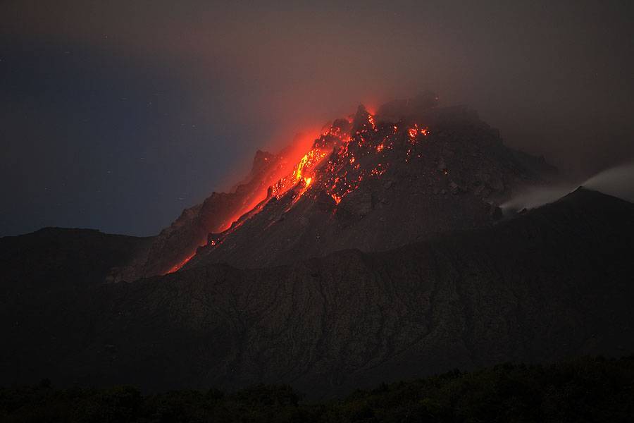
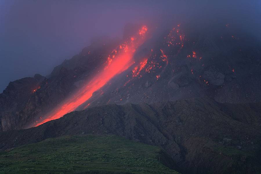
The first night was
spent at the viewpoint getting the first nighttime shots of
the dome which is still about 5km away from this position.
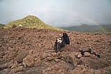
As morning approached we each shouldered 2 rucksacks, one
front, one back, with a combined weight of nearly 40 kg per
person, and descended down the winding road towards the
deserted Bramble Airport and surrounding settlements.
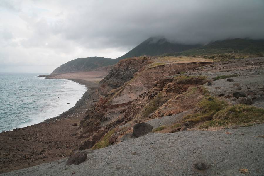
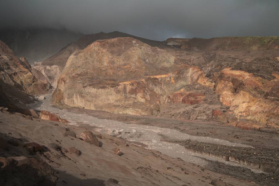
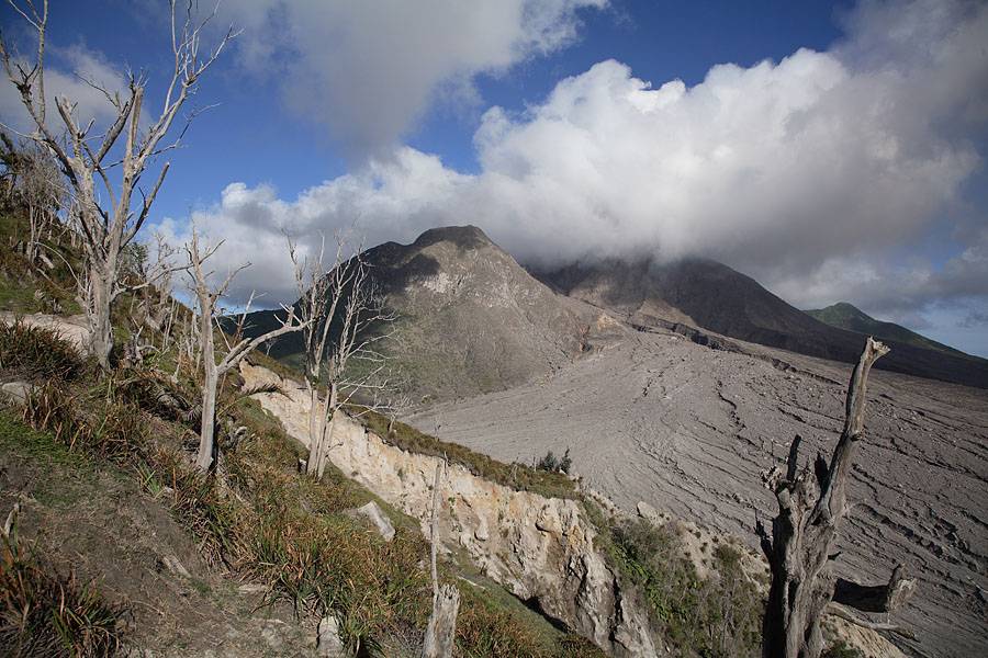
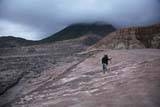
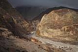
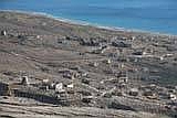
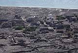
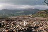
Crossing old pyroclastic flow deposits and erosion gullies
(Fig.3a), we gradually, and in some discomfort due to the
heavy load, made our way towards the deserted settlement of
Bethel (Fig.3b) in the hope of passing through this
overgrown area and progressing towards Long Ground which we
hoped would provide a good safeish (although certainly not
safe) position for pyroclastic flow observation.
 3a
(rr) 3a
(rr)
 3b
(rr) 3b
(rr)
 4
(rr) 4
(rr)
 5a
(mr) 5a
(mr)
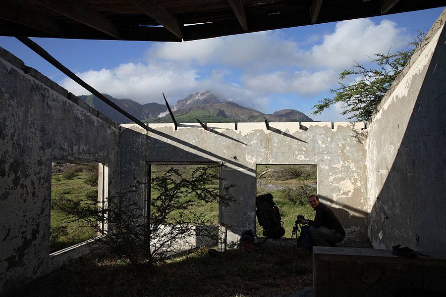
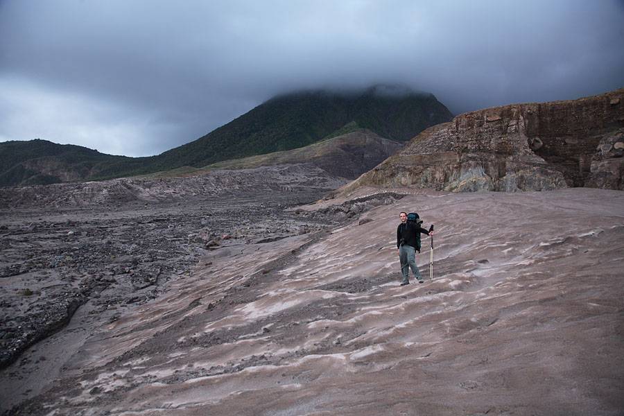
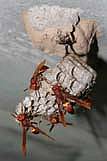
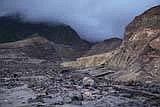
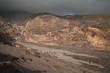
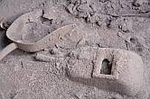
Upon reaching what
remains of Bethel it became immediately apparent that plan A
was going to fail. The area is densely, and
practically impenetrably, vegetated with thorn-bushes and
the buildings are in poor condition and full of wasp nests
(Fig.4). The machete hardly could be said to have cut
through the thornbushes like butter and consequently
progress was painfully slow. Our hopes that at least
the roads would remain in a walkable condition were also
soon dashed as short sections of road just disappeared into
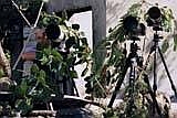
thorny thickets. Well, thank God for telephoto lenses
(but not for creating thornbushes ;-)..). We decided
to find a position where our view was not obscured by
vegetation and then set up camp for the next two nights
(Fig.5a, 5b, 5c).
 5c
(mr) 5c
(mr) 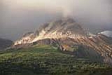 5b
(rr) 5b
(rr)
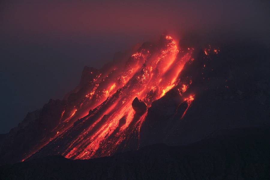
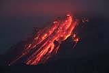
Viewing
conditions were difficult and heavy rainfall on one afternoon
resulted in a cramped and frustrating spell in the tent.
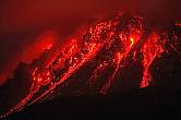
Nevertheless, at least at night we managed to get some fine
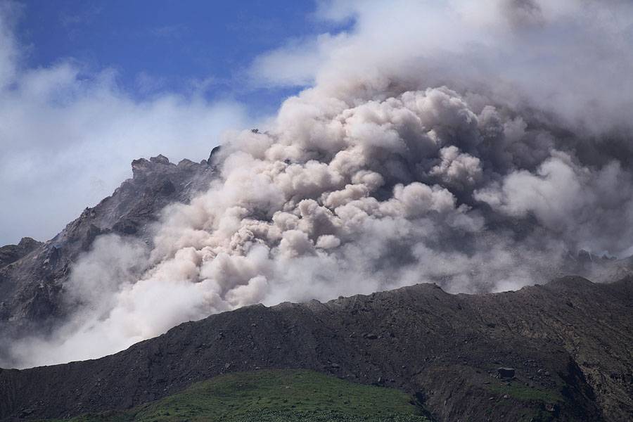
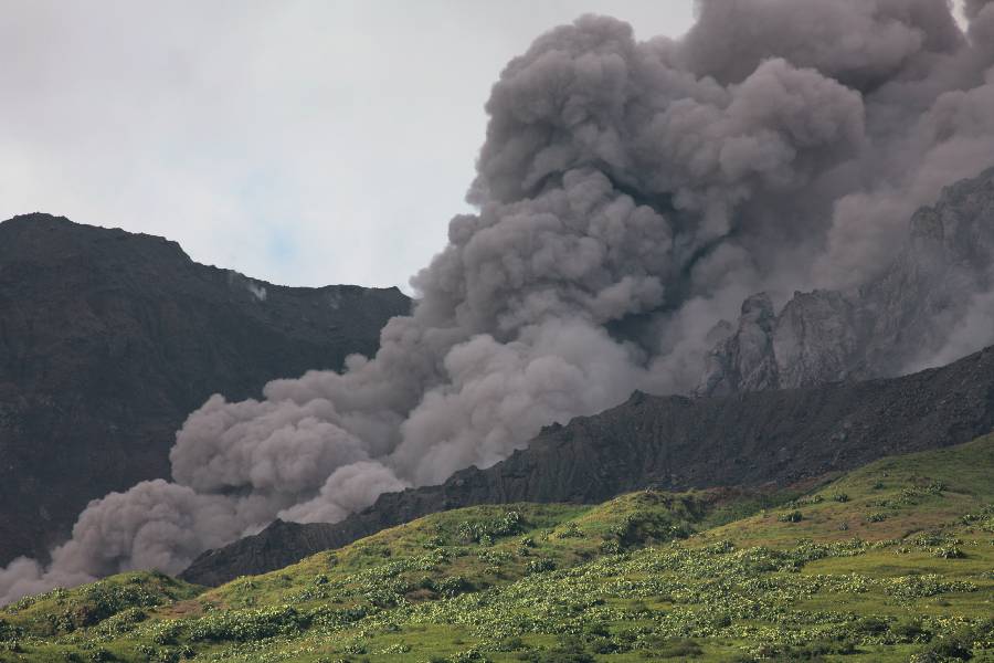
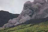
views of the dome (Fig.6a, 6b, 6c) and on several occasions
PFs were visible entering into the top part of the Tar River
Valley (Fig.7a, 7b, 7c). However PF activity was and
remained disappointing since activity had shifted to the
Northern part of the dome, distal to Tar River valley, in
recent weeks.
 6a
(mr) 6a
(mr)
 6b
(mr) 6b
(mr)
 6c
(rr) 6c
(rr)
 7a
(mr) 7a
(mr)
 7b
(mr) 7b
(mr)
 7c
(rr) 7c
(rr)
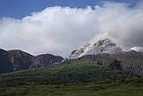
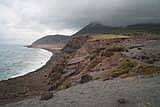
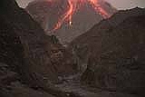
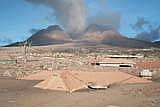
On the third day we
progressed to a position nearer the coast to get a different
view of the dome and in order to position ourselves for a
brief visit to the Tar River Valley via the coastal route
(Plan B). The morning provided the best daytime views
of the dome (Fig.8a, 8b, 8c, 8d), but low cloud arrived in
the afternoon and only part of the dome was visible from
this time onwards.
 8a
(mr) 8a
(mr)
 8b
(rr) 8b
(rr)
 8c
(mr) 8c
(mr)
 8d
(rr) 8d
(rr)
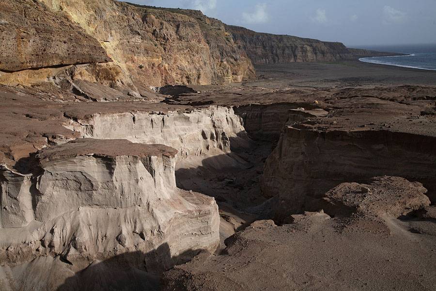
Nevertheless, in the evening we proceeded along the beach with
light backpacks to the small fan of land created by PF
deposits at the bottom of the Tar River Valley (Fig.9a,
b, c). It
should be repeated at this point that Tar River Valley is very
dangerous at any time and progressing to this point and into
the valley could be near suicidal if activity was higher or
more concentrated in the southern part of the dome.
Nevertheless after having observed the activity for the
previous days we decided to cross the Valley, which contains
some deep erosion gullies which would make a quick escape
impossible, and set ourselves up for a night of photography at
a point overlooking the valley.
 9a
(rr) 9a
(rr)
 9b
(mr) 9b
(mr)
 9c
(mr) 9c
(mr)
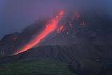
After a
brief shower and in spite of gusty winds blowing sand around
it was possible to take a number of photos of the Tar River
Valley with at least the bottom part of the dome visible (see
Fig.10a, 10b,
10c, 10d).
Note the small PF cloud on Fig.10c (!).
 10c
(mr) 10c
(mr)
 10a
(rr) 10a
(rr)
 10b
(rr) 10b
(rr) 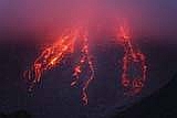 10d
(mr) 10d
(mr)
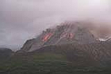
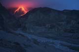
As
morning broke, the clouds descended even further but due to
the low angle of the sun, the yellow and reddish
pastel-coloured landscape presented a wonderful picture
(Fig.11a, Fig.11b, 11c).
Deposits from a recent PF could be seen like a light-coloured
claw on the valley floor (Fig.11b).
 11a
(mr) 11a
(mr)
 11b
(rr) 11b
(rr)
 11c
(mr) 11c
(mr)
After this brief visit
we returned to our previous position. Since water was
running a little low we went to collect some coconuts.
The foray was successful apart from 5 wasp stings to my arm
and numerous thorn-scratches due to rapid flight from the
scene of the attack. This had resulting from trying to
pick up a coconut about 1m away from a wasp nest which had
previously fallen to the ground. This was surprising
since the wasps generally seemed to be quite tranquil and
approachable. Nevertheless, it had been worth it and thanks
to a major effort by Martin with the by now blunt and bent
machete, coconut juice and flesh was in plentiful supply.
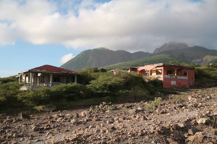
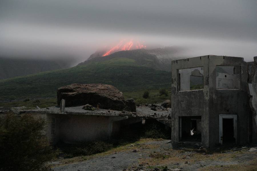
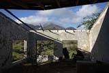
The final night was
uneventful and provided only little photographic
opportunity. One had to settle for a few shots of a
house with a boulder perched on its roof (evidence of the
tremendous force that can be developed by Lahars) with a
little glow in the background (Fig.12). The climb up
Jack Boy Hill was hampered a little by a newborn goat which
decided to adopt me as its mother as we passed. Well i
wouldn't have minded adopting the little fellow, yet my
inability to lactate would have rapidly become a problem.
Thus, after carrying it to its mother failed, gently
prodding it with feet and telescopic sticks until it ran
into the bushes at the side of the road did the trick
(luckily we saw it several days later reunited with its
mother).
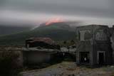 12
(rr) 12
(rr)
After 4 days at the east
side of Montserrat, it was decided to briefly visit the
deserted capital Plymouth and as the opportunity arose to
take a drive up St Georges. We installed ourselves in
the View Pointe Hotel which provides a comfortable and
friendly base for exploration of this part of the island.
The drive up St Georges hill can easily be arranged by Taxi
(unless the Exclusion Zone is extended to this area again),
however costs are high and best shared with further
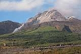
visitors. Since we visited in the afternoon, the
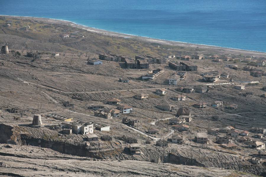
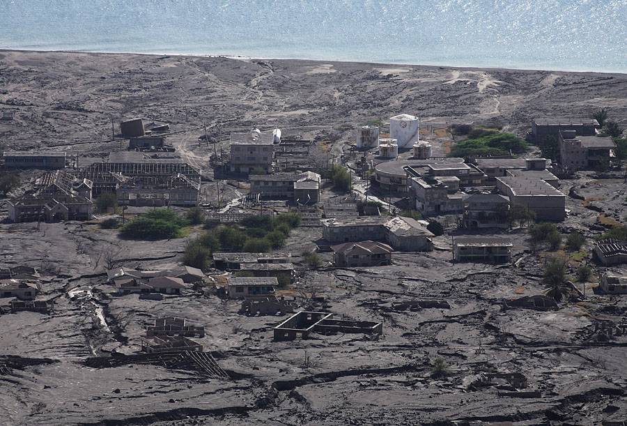
volcano presented itself in bright sunlight (Fig.13a, 13b).
The view from St Georges Hill provides a good impression of
the extent of lahar damage on this side of the Island
(Fig.14a, Fig.14b).
 13a
(rr) 13a
(rr)
 13b
(mr) 13b
(mr)
 14a
(rr) 14a
(rr)
 14b
(mr) 14b
(mr)
After a relatively
relaxing day involving stocking up again on food and water
and the St Georges Hill visit, we walked into Plymouth the
next morning. Due to increasing danger from the
volcano, the workmen present in January are no longer
entering the town. After nearly running into what
appeared to be a police patrol (this could prove very
expensive since fines of approx. 800 USD are apparently
levied on unauthorized exclusion zone entrants), we decided
to spend much of the day inside buildings looking for photo
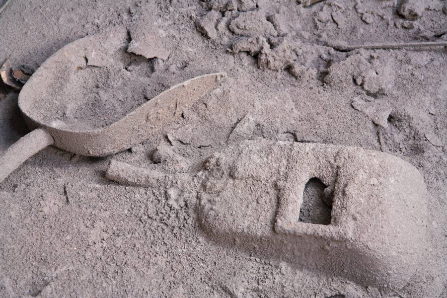
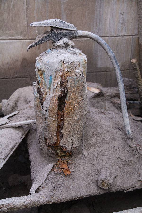
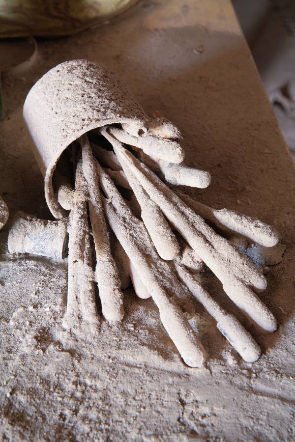
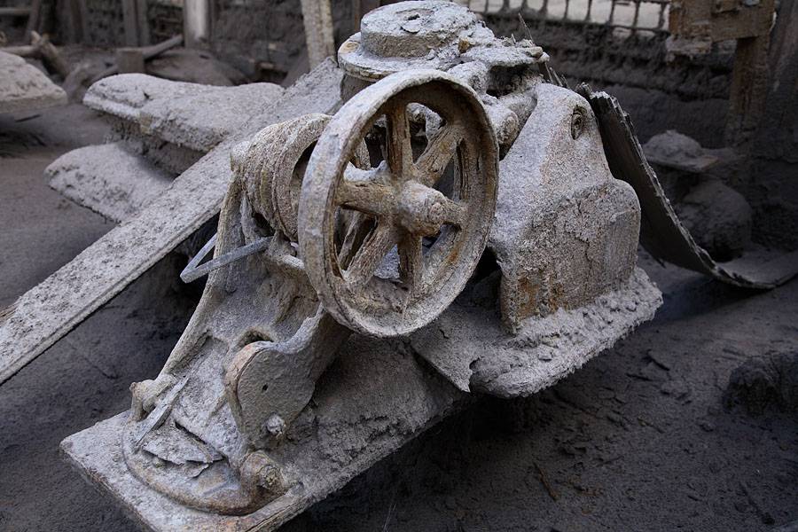
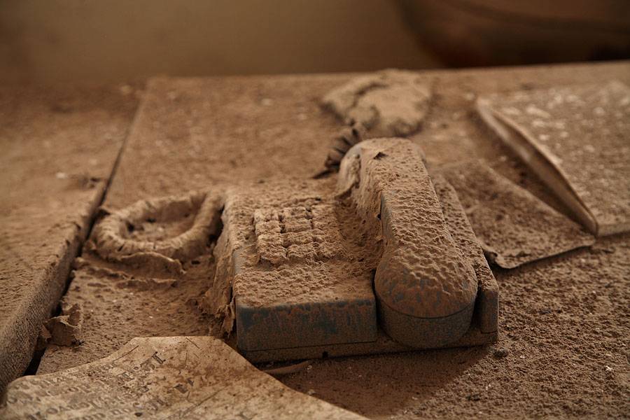
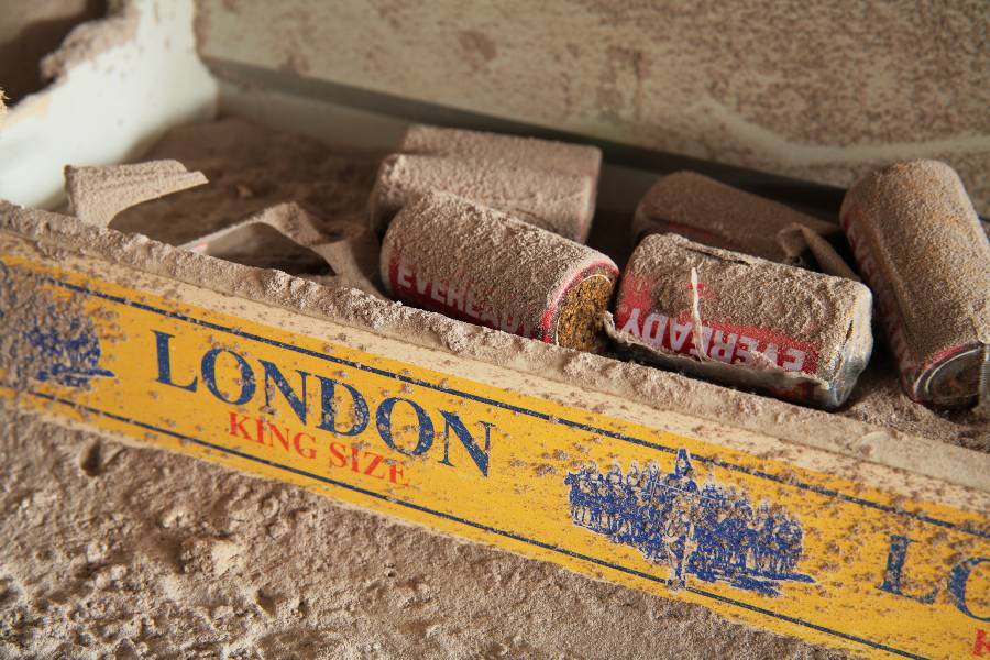
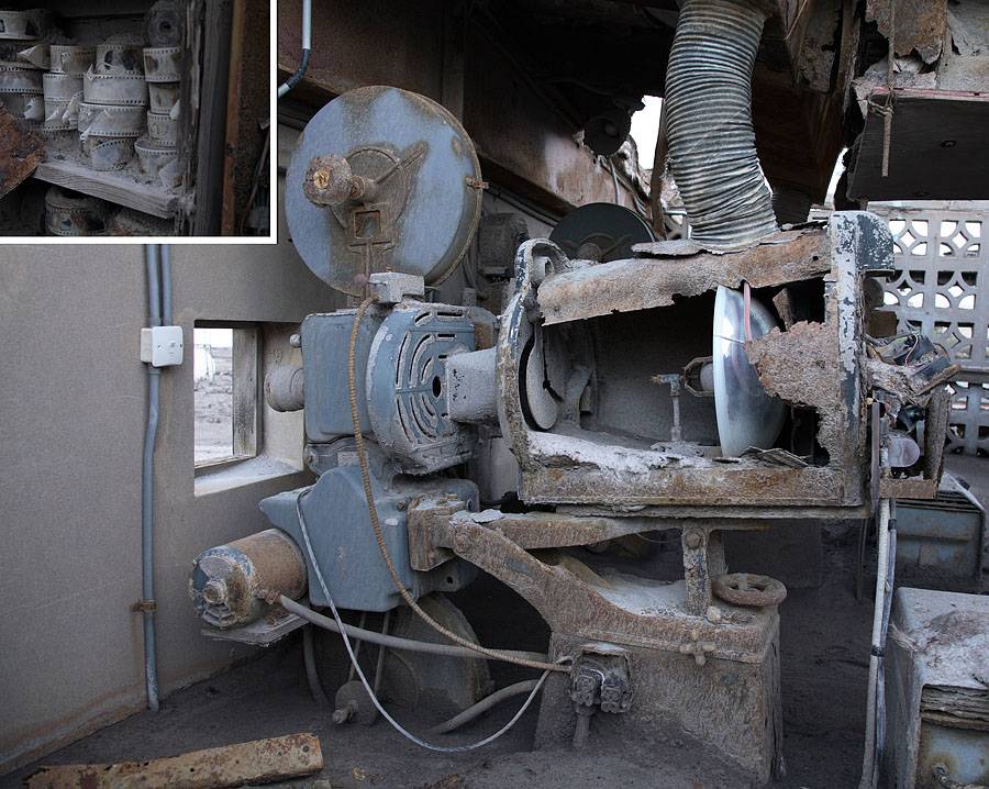
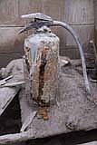
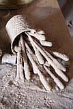
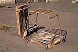
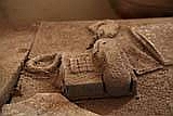
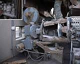
motifs. Several interesting motifs were found in the
workshop and classrooms of the Montserrat Technical College
(Fig. 15a, 15b, 15c, 15d) and in and around local stores
(Fig. 16a, 16b, 16c, 16d).
 15b
(rr) 15b
(rr)
 15a
(mr) 15a
(mr)
 15c
(rr) 15c
(rr) 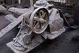 15d
(mr) 15d
(mr)
 16a
(mr) 16a
(mr)
 16b
(mr) 16b
(mr)
 16c
(rr) 16c
(rr)
 16d
(mr) 16d
(mr)
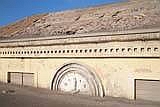
It is
noted that we did not break into any locked buildings (the
majority are open anyway), neither were any items removed from
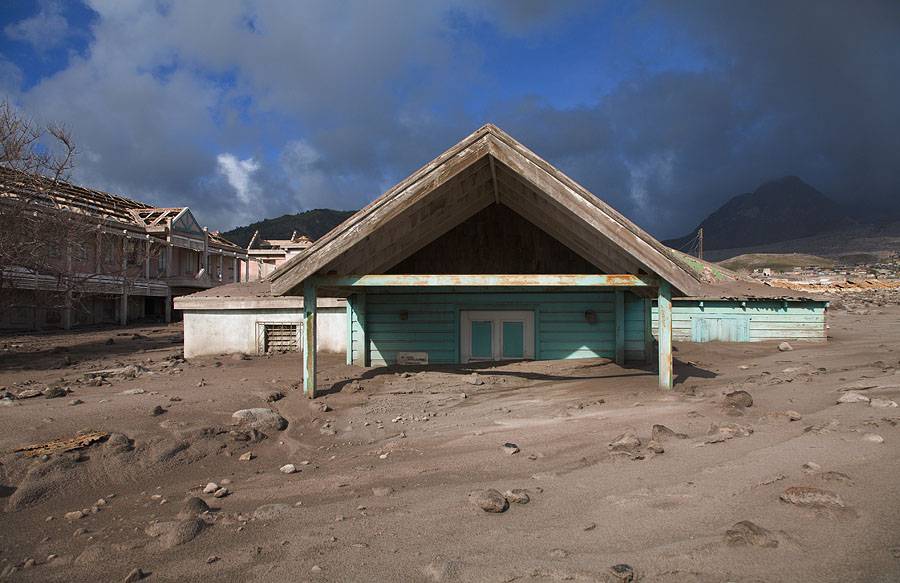
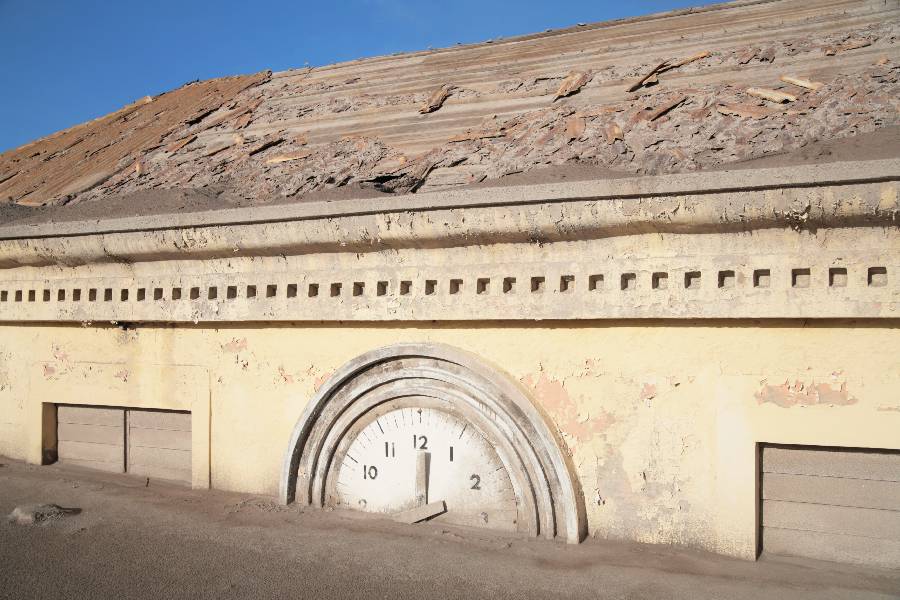
the site. In the afternoon we ventured towards the former
center of town and had a relatively clear view of the volcano
in the background. The following figures show buildings
in the center of Plymouth (Fig.17a, 17b, 17c, 17d).
 17a
(mr) 17a
(mr)
 17b
(rr) 17b
(rr)
 17c
(rr) 17c
(rr)
 17d
(rr) 17d
(rr)
After sunset we left
town, machete in hand in case of pig attacks, and after a
brief walk got a ride on the back of a pickup truck to the
Belham River Valley crossing from where we proceeded on foot
back to the View Pointe Hotel. People who choose to
enter the exclusion zone should be aware that there have
been a number of reported attacks by large (formerly
domesticated) pigs. Forget "Babe", this is big mean
marauding bacon. Rumour indeed has it that a number of
people have disappeared in the zone in recent years.
Some claim that the pigs may be responsible, although there
is no direct evidence of this. Nevertheless, it would
certainly not be a very glamorous way to go !
Consequently, it seems wise to carry at least a machete to
provide some protection. Certainly, holiday in the
exclusion zone at times seems like a holiday in a farmyard,
with pigs, cows (incl. large bulls), donkeys and large
numbers of goats wandering around (Fig.18).
 18
(rr) 18
(rr)
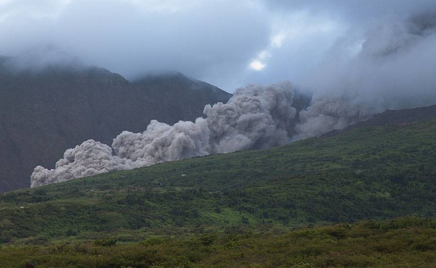
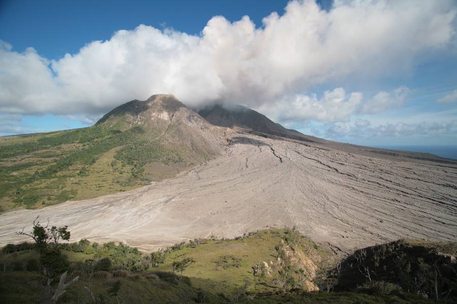
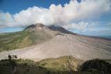
On the penultimate day
of our visit we descended again to the vicinity of Bramble
Airport in the hope of catching further glimpses of the dome
(Fig.19). Unfortunately the entire dome remained in
cloud for the much of this visit and we encountered a rather
unpleasant number of biting insects.
 19
(rr) 19
(rr)
The next
day we left for the airport somewhat disappointed and after
the short flight to Antigua spent a couple of hours in its
capital St John before getting onto the BA flight back to
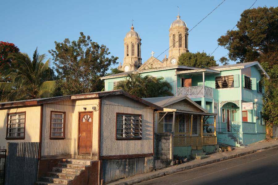
London. Interestingly, the style of many of the
buildings in St John is similar to that of many of the
buildings that have been lost in Plymouth (Fig.20a, 20b).
 20a
(rr) 20a
(rr)
 20b
(rr) 20b
(rr)
The Soufriere Hills
Volcano is currently again in a phase of rapid dome growth.
Entry into the exclusion zone is illegal and is not
encouraged by the author of this report. Those
entering anyway need to be aware of the dangers from
wildlife, building collapse and in particular pyroclastic
flows or lahars. In particular the area around Tar
River Valley should be avoided, yet as the dome breaches
other parts of the wall formed by remnants of the 2003 dome,
further areas will be at very high risk of pyroclastic
flows. All areas around the dome would be at high risk
in case of a major dome failure even at the present time.
Visitors should remember that Pyroclastic flows have reached
as far as Bramble airport (about 4km from the dome) in
previous eruptive episodes. Recent activity reports
can be viewed on the informative Montserrat Volcano
Observatory website (www.mvo.ms) . It is noted that
staff at the MVO currently strongly advise against any entry
into the exclusion zone.
More about at:
Photovolcanica.com

|