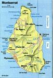
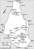
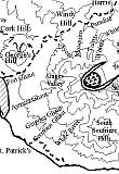
Maps of Montserrat Island
A two-week break after the great trip to Japan arranged
us to organize again a journey into the Caribbean
volcanic world. The intention was the Soufriere Hills
volcano on the island Montserrat. Shift operation, after
Marc Szeglat and Chris Weber tarried since the 18th of
January on the island Marco, Martin and Richard started
at the 24th of January to try their best. About four
days later I traveled afterwards, and returned at last
of all at the 8th of February back to Germany. This
delay turned out afterwards as a magnificent stroke of
luck.
 tb
tb
Escaping from the snow chaos at Munich.
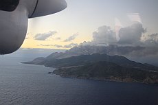
Welcome eruption on the way to
Montserrat

 tb
tb
With luck I could escaped from the white
snow hell of Munich with the first aircraft to London. After
this flight all following flights were radically cancelled
for the next two days, because of the strong snowstorms in
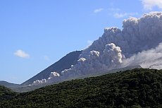
whole Europe. Arrived at Montserrat, the first way took me
to a paradise looking viewpoint the Jackboy Hill,
which is situated at the east edge of the exclusion zone.
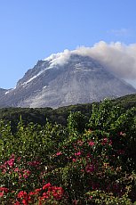
Perfectly free the now up grown dome of the Soufriere Hills
volcano with an estimated height of 1070 m stood
impressively in front of
me.
 tb
tb
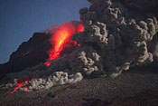
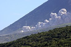
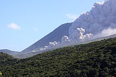
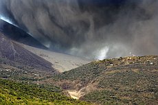
Pyroclastic flows through the Tar valley seen from
Jackboy Hill
Due to the previous reports
of Richard and Martin I realized that this circumstances
belong to a meteorological pecularity. Besides this, already
lively Pyroclastic Flows (shortly PFs called) could be
observed. From the Tar River to the northern slopes these
feared 'glowing clouds' went down in an hourly rhythm
crossing the landscape. Highly impressing, even from a
distance of apprx. five kilometers.
 mr
mr
 mr
mr
 mr
mr
Front
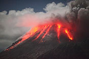
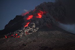
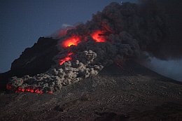
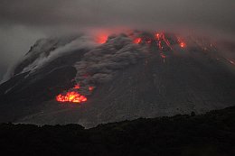
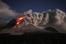
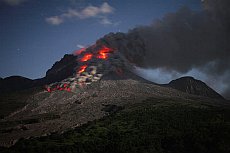
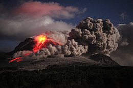
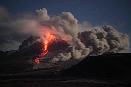
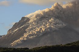
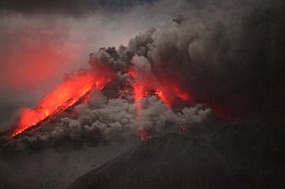
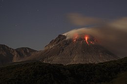
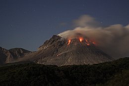
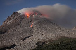
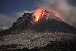
glowing PFs by night
The
continuing activity delighted, and during the night PFs in a
front-glowing condition could be observed. Taking a very
short exposure time Martin took this fantastic photographies
and animations by using a bright optic with a high ASA. And
the are glowing in the nite! James the dump worker, would
discribe this in an caribbean slang. Da an'sa, it i'a gloin
in nite! This question whether the down racing fire tongues
are visible with a glow by night, could no one answer me for
a long time. But the pictures point it out clearlypushed
itself upward the dome.
 rr
rr 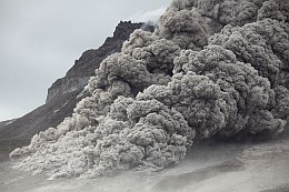 rr
rr
 mr
mr
 tb
tb 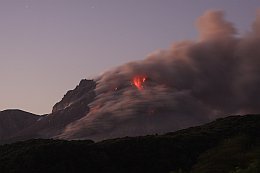 tb
tb
 mr
mr
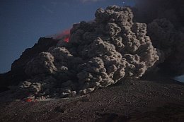
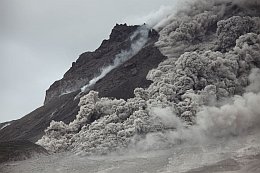
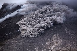
When plentiful mass pushed
itself upward the dome, the top gets instabil and large hot
rock masses crumbling down to an evelance. Further the
loosen slope ash get involved by creating a Pyroclastic
Flow.
 tb
tb
 rr
rr
Glowing Dome
The onward pushing andesite
dome mades itself noticeable by rumbling of the contiuing
rock fall. One has the feeling that in the upper range a
constantly alternation is going on. Diverse
time-laps-studies over days shows clearly the dome
changes by a constant movement.
During one week the dome activity can change
completely from east to north. Due to this instability you
never can get the sureness which area of the volcano is
maltreated by the PFs. Contrary to the dome pushing, also an
explosion can trigger Pyroclastic Flows.
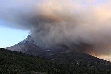
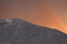
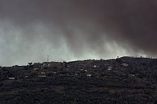
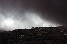
Activity the days before.
 tb
tb
 tb
tb
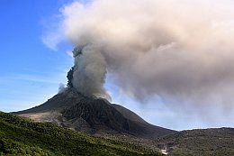
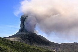
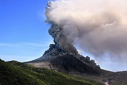
Explosion at the 5th of February
 tb
tb
So,
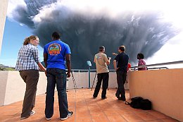
I stood now on the balcony of the
Montserrat Volcano Observatory (MVO), and did not know actually what do do
with the last Montserrat day. Well, may I make a few
animations or films from the Bellham Valley with the
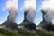
traces of the past Pyroclastic Flows. Since 1:35 pm I could
see an increasing ash venting at the dome, which could be
observed several times during the past days. No reason to
get agitated, without knowing that in a few minutes all
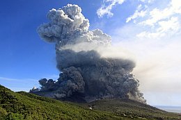
would change rapidly. 13:49: I looked straight to the
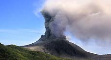
volcano when suddenly five black ash jets shot out
from the main ash column without an announcement or big
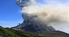
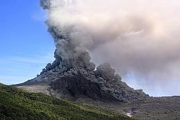
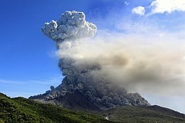
noise. Wow! Up in seconds an ash/pumice stone column piled
itself apprx. 1000 meters up, and sagged down again. The
back-rushing material crashed on the dome and released a
powerful Pyroclastic Flow going rapidly down in western
direction. Very interesting to notice, the procedure went
nearly loudless and without a volcanic noise.
 tb
tb
The plume arose apprx 7-8 Km
Now a hectic
rush and certain nervousness arose at the observatory.
Everyone ran crosswise in disorder, the director cried the
remaining MVO crew out from the house. Explosion, an
explosion is going on….! I ran to my video camera and wished
myself to serve simultaneous the other camera still two arms
in addition. The desire was not fulfilled, and I had to
bring my stuff somehow with my native two hands in position,
without making a failure now!
 tb
tb
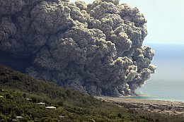
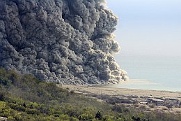
Pyroclastic Flow reaches the sea
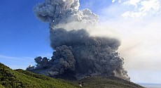
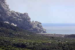
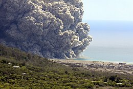
Everyone stared glued
at the grey monster which seemed to sank completely in the
ashes. Now with an enormous speed the PF started over the
entire width of the western slope and disappeared behind
Georges Hill. Further PFs went down at the northern area.
Everything seemed to degenerate now in its dimension, and
even from an approximately 4.5 km distance everbody felt
somehow unwell. No one could predict, what happens next.
 tb
tb
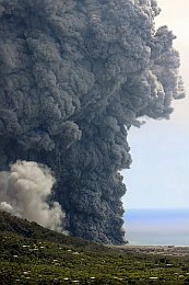
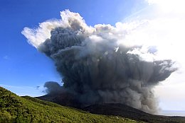
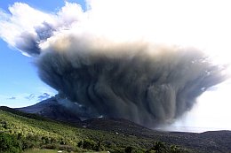
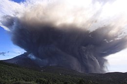
The ash
cloud piled up very fast to an apprx. height of five km
right in front of us and reached at the end the height of
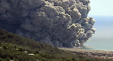
eight km. Clandestinely the big PF emerged behind Georges
Hill again, and tooks its way relentlessly over Plymouth
the sea. With contacting the sea water, an enormous ash
steam developed itself immediately. In comparison with the
already vacated houses of Plymouth, the dimension and
destructive power of a Pyroclastic Flow became conscious.
 tb
tb
Originalreport from the 5th of Februar,
Montserrat Volcano Observatory (MVO)
At 1:49 pm 5th Feb 2010 a vulcanian explosion
occurred from Soufriere Hills volcano
The event lasted 7 minutes
and sent pyroclastic flows mainly to the west of the
volcano with pyroclastic flows rapidly reaching Plymouth
and spreading across the sea for around 500 m. Short
pyroclastic flows, up to 2 km runout, also travelled
down Tyers Ghaut to the northwest and Whites Ghaut to
the northeast. A plume rose rapidly to 21,000 ft
(confirmed by pilot reports). There was no lapilli or
ash fallout in inhabited regions due to an easterly wind
direction. Precursory activity included only ash
venting, although the event coincided with a cycle of
increased activity
.
 tb
tb
|
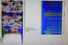
The beginning of explosion together with the seismic
recordings. The blue and green amplitude needs more than
the half of the paper (right photo with friendly permission by
MVO) |
If you factorize all parameters in which must be
set right for observing of such an explosion
successful, you get in fear.
-
the activity should be during the day,
-
you have to stand on the correct side of
the island,
-
the weather must be clear, the
dome ist normally 80% in clouds,
-
the wind must come
from the right direction,
-
the
cameras have to be well positioned
(with
full accus CF-cards!), and you should press 'record'
before filming....
-
and the most important, you must be
present in these 7 minutes, and not in a restaurant,
shopping or sleeping....
 tb
tb
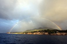
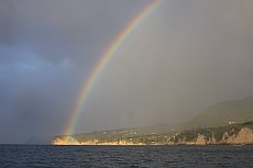
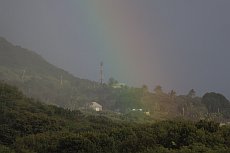
At the end of the rain bow... the MVO is situated. A
sign-posting?
DOME COLLAPSE on 10th of February2010
Alteration of the volcano landscape and devastation of the
'Harris' areal
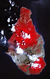
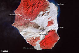
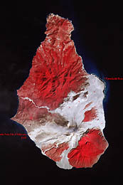

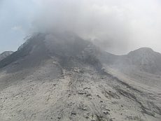
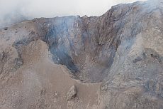
The satellite images by NASA are pointing out the change
of the landscape around Soufrierre Hills volcano
before and after the activity period 2009/2010. The
routes of the new pyroclastic flows are clear to
see.
All satellite images, credit to


 gs
gs
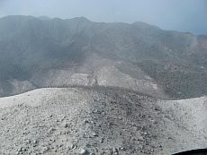
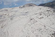
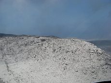
The final big show of the activity chapter 2009/2010
occured at the 10th of Februry 2010 by a dome collapse.
That means that the upper crater body bursted self-inside
and also down to the northern slopes. The downsliding mass
devasted the abandoned areas around Harris, Streatham,
Bramble airport and Spanish point.
 gs
gs
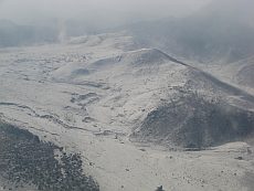
The giant pyroclastic flow run down the northern flank of
the Soufrierre Hills volcano and mainly over the
north-east
parts of the Harris-Streatham-Bramble areal. Pyroclastic
flows ran also down the Tar valley.(
 Map).
Only demolished
trees and destructed buildings are now the quite
remainders. More than two kilometer behind the 'Harris' hill
the PF destroyed the forests completely.
 gs
gs  tb
tb
 gs
gs
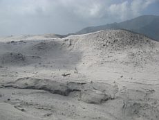
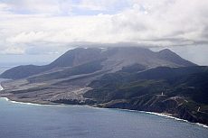
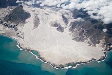
If you compare the landscape for example the Belham
river valley which has a similar apperance like the
devasted area before, you'll get conscious what
enormous energy and power of destruction stands behind
such a pyroclastic flow.
 tb
tb
 gs
gs
 tb
tb
 gs
gs
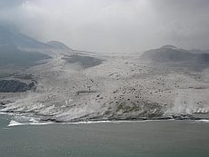
Again in comparision the old Bramble airport facilities
and Spanish point before and after the pyro attack. The
thickness of the ash layer measured partly up to 15m
Heli images with
friendly permission of Greg Scott (gs),
Caribbean
Helicopters.
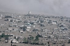
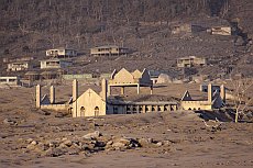
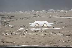
Pyroclastic land
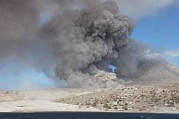
Due to the
explosive situation the access in the restricted area is not
possible and deadly dangerous. A good alternative offers a
boat trip. Boats can be lent in the port of St. Johns (price
per Person 60-80U$). From there you get a good view to the
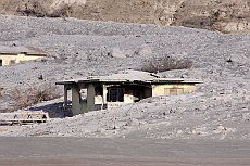
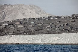
abandoned city of Plymouth, the modern Pompeji in rates. May you are
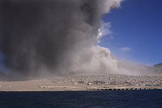
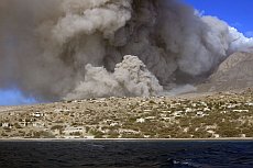
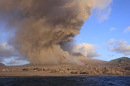
lucky and you'll adjust directly a PF, and you have the
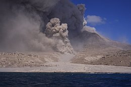
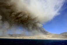
feeling the clock is turned back to 1996. In our case the
volcano had a strong active phase in the afternoon of the
2nd of February and the whole scenario was deep
impressively. Again the power of the volcano could be
brought in connection with buildings. Advice: Take a strong
telelens with you. An adequate 2 miles distance to the coast
should be kept absolutely.
 tb
tb
The former
river depression at Aymers Ghaut gets regularly afflicted.
 tb
tb
 rr
rr 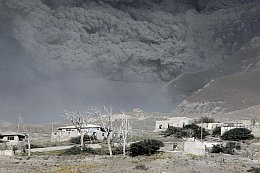 tb
tb 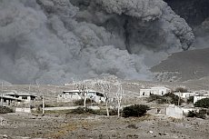 tb
tb
Approaching PF (Telelens up to 500mm).
 rr
rr 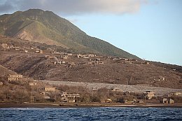 rr
rr
 tb
tb
 tb
tb
 tb
tb
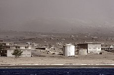
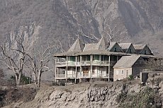
What the multiplicity of Pyroclastic Flows
can't destroy the Lahars will take rest. Of floated rocks
by Lahars in the
background can be seen and may carry the symbolic of
millstones. Slowly
the volcano conquers the city back again and may create a
new paradise in the far future.
 tb
tb

 28
28

